
Hiking Cerro Castillo in the Aysen Region is a wonderful alternative to the more famous camping and hiking routes in Chile. It offers spectacular views, interesting trails, varied scenery and it is a quiet trail with not many people. It sounded like the perfect way to celebrate our 20th anniversary!
(If you want to check out the day hike from Villa Cerro Castillo, skip down to the bottom and start reading from Day 3. And I recently went back and did Cerro Castillo again in 2022, this time for 4 days, which you can read about here.)

Our in-laws said to take a 10 day holiday and they would look after the children, so we (ok, I!!) decided on a three-day hike through Cerro Castillo national park which is south of Coyhaique. It involved some planning and figuring out how to maximize our time and not break the bank. We did this hike combined with a road trip down the Carerra Austral — perfectly mixing a back-country camping trip with the second half of the trip devoting to sight seeing, day hikes and staying in nice cabins.
The first logistic was figuring out how to get there and make the best use of our time in the area. We wanted to make this trip about what we really wanted to do and make use of the opportunity to do things we might not necessarily do with the children. As we live in Santiago we do have the luxury of being in the country, but we have limited holiday leave and we aren’t on a month long holiday exploring for weeks on end. We debated taking buses, or getting transfers or hiring cars. But due to the distances and airports, in the end we figured our time was also worth quite a bit.

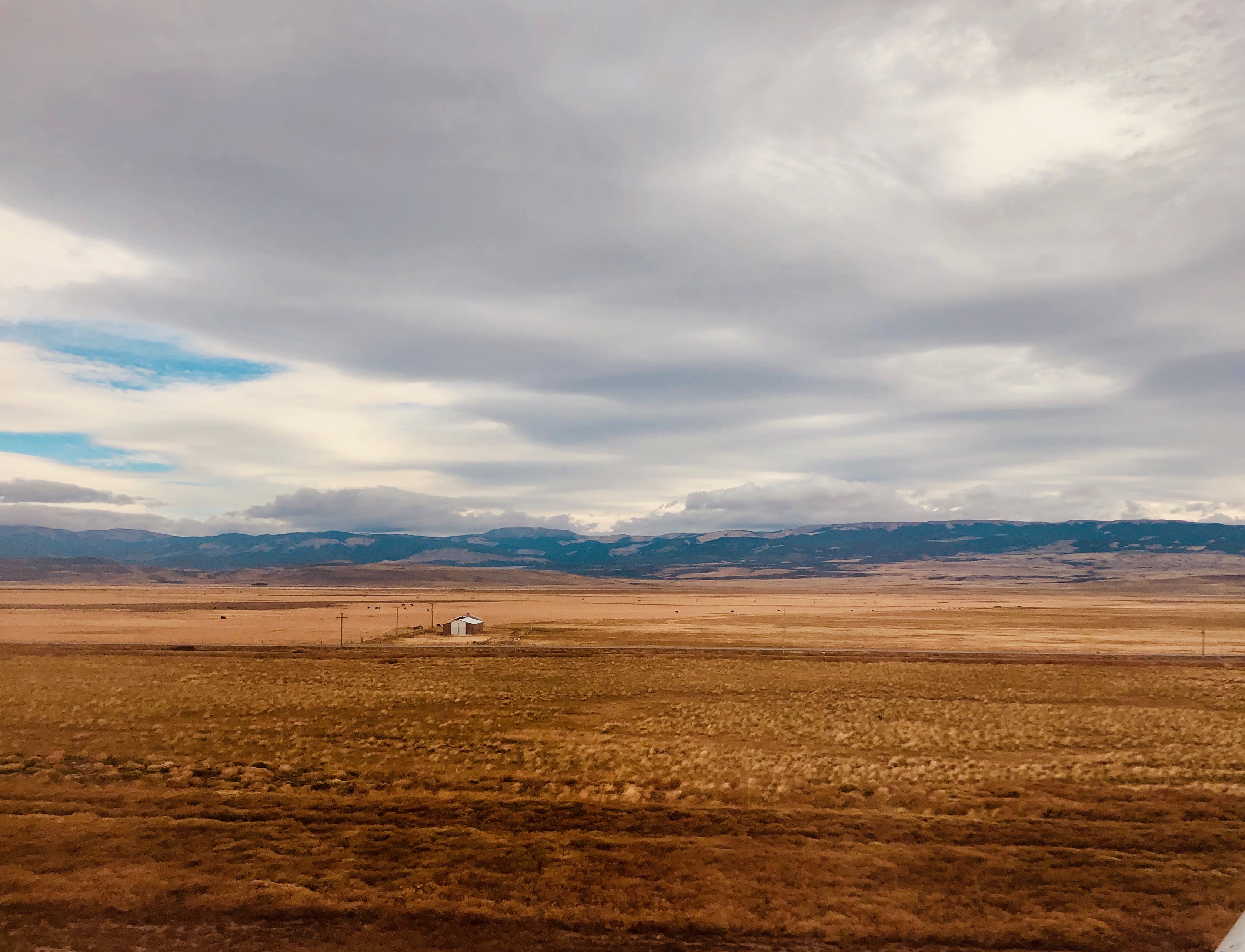

Views of the Carrera Austral highway from the plane, wide open skies and driving down into Villa Cerro Castillo.
Day 1
We left on the first flight out of Santiago (7 a.m.) to Balmeceda airport. Now. Everyone says “fly to Coyhaique”or “rent a car in Coyahique”and there is the city and region of Coyhaique but the airlines fly into Balmaceda which is actually a largish town about 40 minutes drive south of the city of Coyhaique. There are a few car rental agencies at the Balmaceda airport, but, (get this) no grocery stores, camping gear stores to get fuel and matches and no petrol stations for when you drop your car back. Those amenities are all located in the city of Coyhaique.
We connected with an absolutely lovely couple, Clara and Federico. They are originally from Argentina and now they run the great web site Villa Cerro Castillo. They can help with cabins, campsites, transfers and more. I emailed Clara and we eventually worked out a plan that my husband and I would hire the car at the airport on the first day and drive the hour to Villa Cerro Castillo. We arrived mid-morning and Clara let us park our rental car by their house. They had picked up three camping gas canisters for us and matches. We filled up our water bottles and Federico drove us the 30 minutes back up the road to the beginning of the trailhead. We were hiking by about 12:00 p.m. on the first day.
We had friends who had made a last minute trip to see us the previous November and they couldn’t get into Torres del Paine, so as I had already roughly sketched out our trip for the next March, they were my guinea pigs. As she said “we bookended the season”and we had very different weather between November and March!
In March, when we set out, it was cloudy but the trail was really dry. When we arrived there was a small hut and two people who gave us a map and charged us $23,000 CLP each to enter (our friends paid $9,000 each). They said to keep the ticket to show the rangers on the trail and for when we exited.

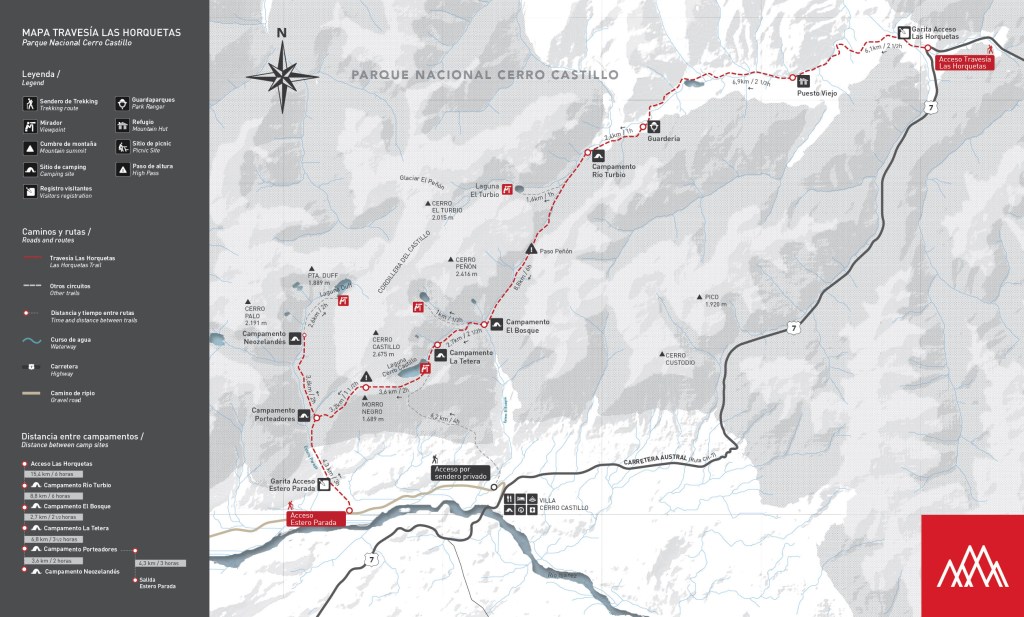
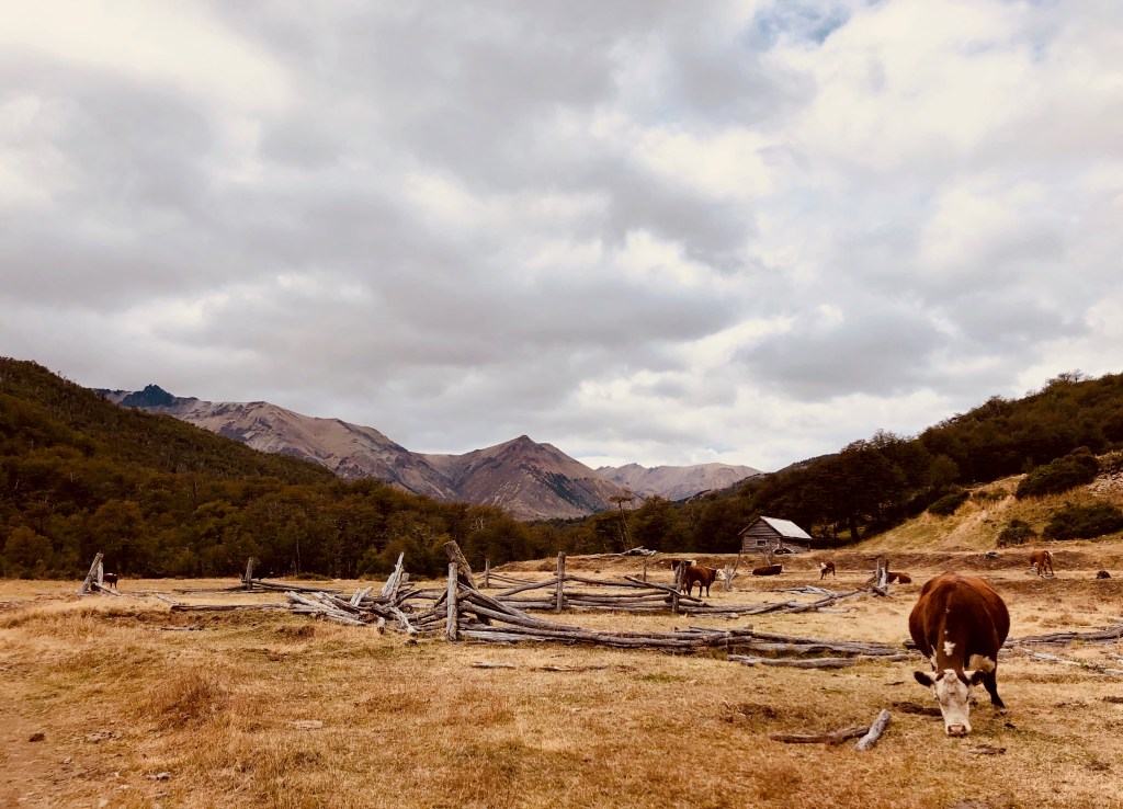
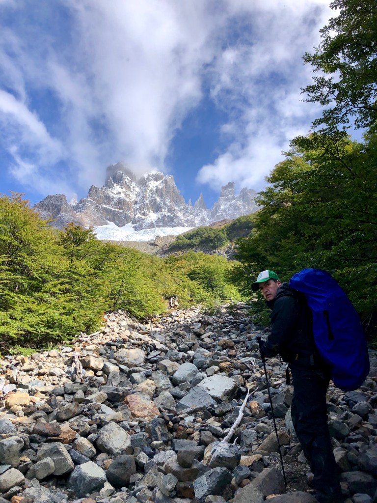
You need to enter the Las Horquetas entrance before 1 p.m. to ensure you have enough time to get to the first campsite. You start out on pastureland and a farm road with loose stones. There aren’t many confidence markers, but it is really obvious. It rolls up and down and you have pretty views and lots of cows. Our friends had really wet weather and suggested sneakers for the first day (which we brought but we never had to use them on the trail.) We could cross the rivers and streams easily on makeshift boards or stones, but our friends in November got really wet.


When you officially enter the national park (after walking for 2-3 hours) there is a ranger hut (it was closed when we were there). There is a small campground and outhouse.

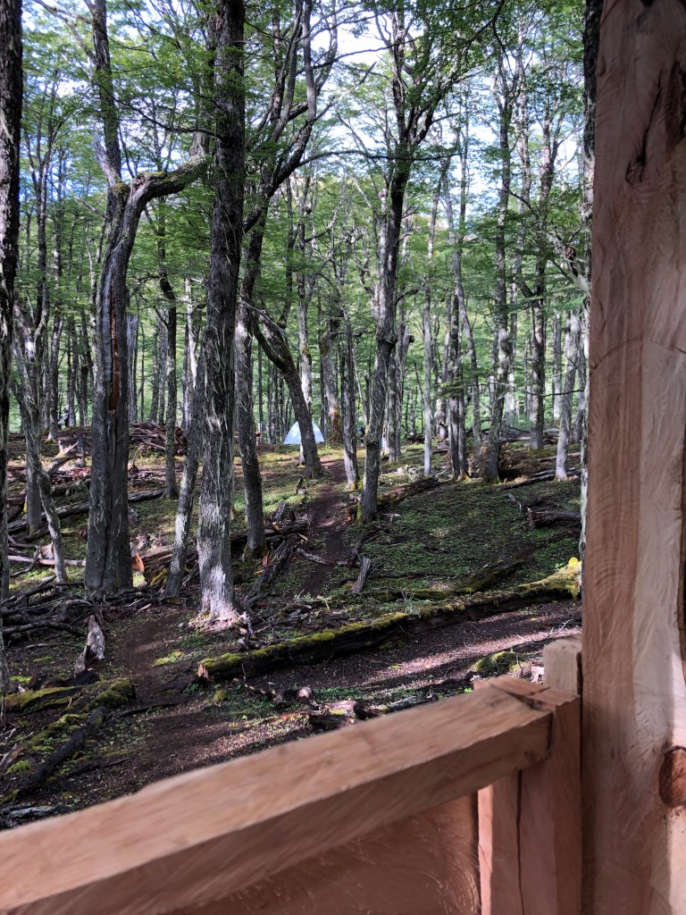
We kept walking for another hour through the woods and over some river stones and streams. Eventually you will see the river widen and a sign that says no campfires and it looks like the campsite, but keep going on the trail and across the creek bed and you will see a tent sign and that is the next campground. We thought it was was more beautiful than the very first one as it’s in the woods and also along a rushing mint-green river. It also means one hour less to walk on the second day. There are quite a few driftwood shelters set up to block the wind for your tent. We arrived around 4 p.m. and chatted with some of the other campers. We made supper and set up camp. It wasn’t particularly cold and we were fine in our sleeping bags which are rated to minus 9C.
The trail is marked with a variety of markers- some cairns, yellow upside down triangles, arrows made of stone or driftwood, and red or white paint on rocks.


Day 2
We brought all freeze dried camping suppers, sausage/cheese and bread for lunch and oatmeal and freeze dried blueberries for breakfast. I also had these Juan Valdez mini coffee pouches (like a tea bag) for actual coffee in the morning. A treat! But that first morning do you think Mark could find the matches? We looked and looked and couldn’t find them. Finally he borrowed some off a fellow camper. Then, just as he had packed up and were getting ready to go he went to the outhouse and realized the matches had fallen (during his first trip to the outhouse early that morning) out of his pocket and got wedged between his long johns! We were relieved to have our pack back and returned the precious borrowed matches!
The second day you need to climb up over hills through the woods to Peñón Pass. The rangers suggested we leave campsite we were at (campsite number two) before 9 a.m., to get to the pass before noon to avoid the strong afternoon winds. Even with the matches fiasco we did leave by 9 a.m. The good news is we got there by 11 a.m. and there was no wind. The bad news ….


We had a slight drizzle which rapidly turned to sleet and then snow on the pass. We had about 5 cm of snow. We were glad for our mittens. Our friends in November went over the pass in glorious sun and they were wearing tank tops!
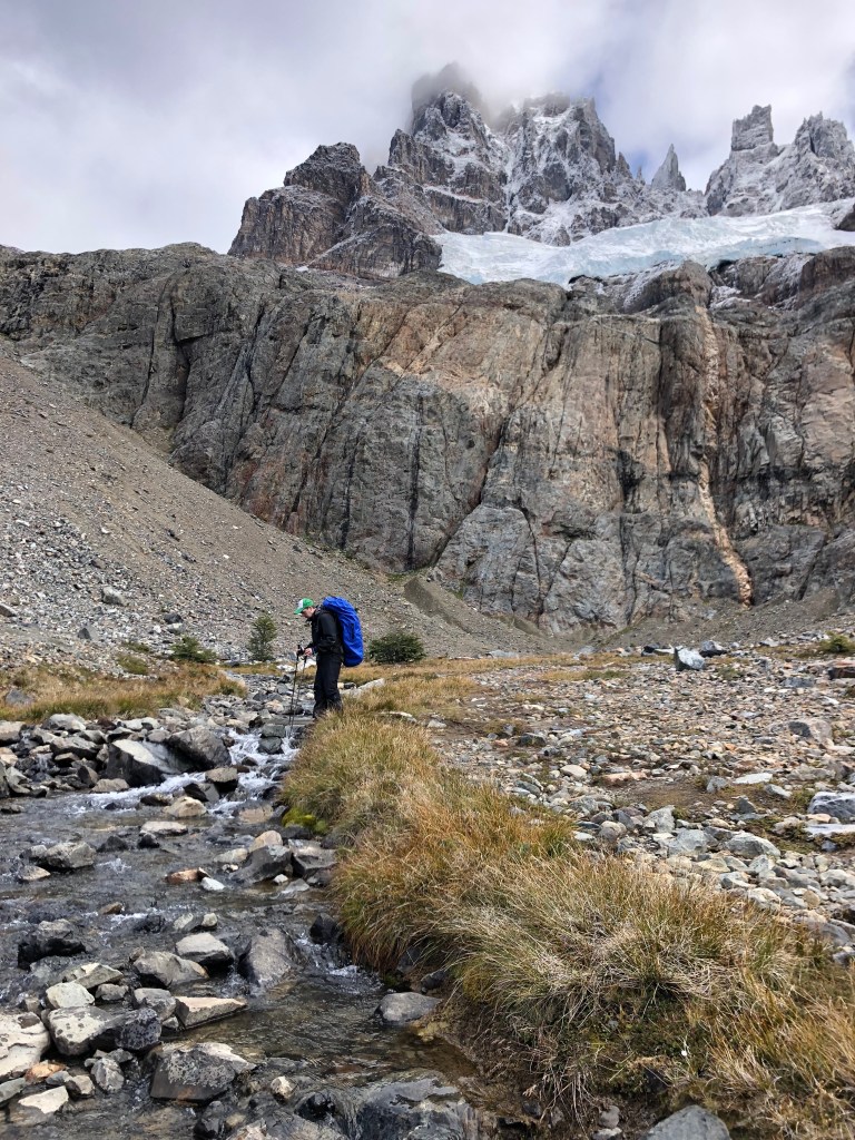
After the pass it is a long, steep descent through massive rocks. It was cloudy when we went down but pretty to see many mini waterfalls and the valley below. You can see trees at the bottom and I thought that was where the campsite is, but it isn’t. You’ll come to a larger river crossing, look to the left (down river) and you will see a nice place to cross with a stable plank across the rocks.
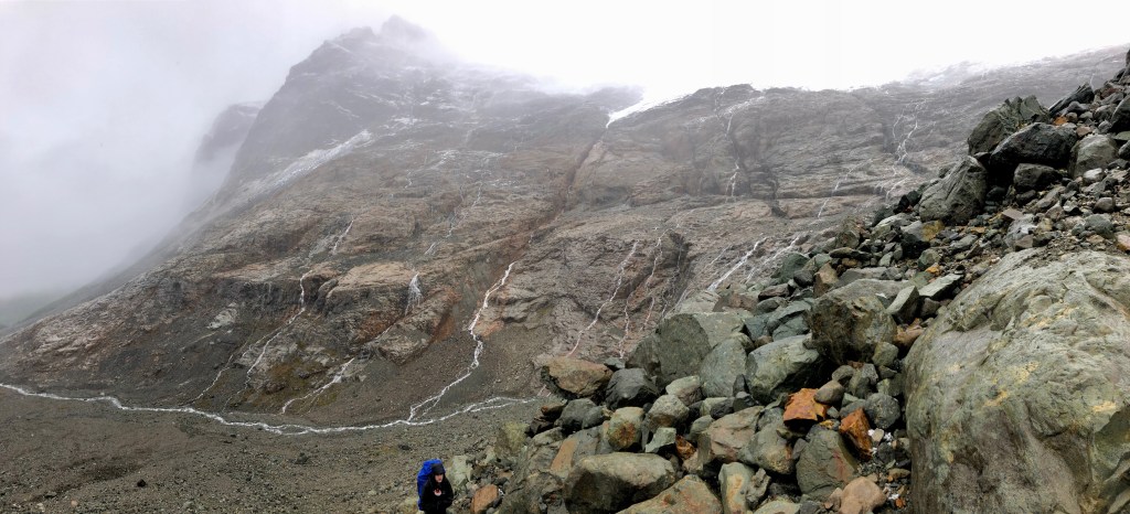


After another 30 or more minutes of hard uphill walking you’ll arrive at El Bosque — a nice place to stay the night. It was our only option to camp as the site further on and closer to the laguna (La Tetera) was closed due to misuse by campers. La Tetera, when it reopens, would be a gorgeous campsite with stunning views but very cold and windy as it’s more exposed. And there is quite a bit of climbing to get to La Tetera at the end of a long second day. Our friends were able to stay there in November and it was beautiful for them to wake up and see the Castillo in the morning. But it didn’t matter as it was closed, so we pitched up in El Bosque. Which is a bit like teetering on the edge of a gorge. You can walk down the gorge to the stream to get water. There was a ranger there and he let us know La Tetera was closed and that he would also be closing the Neozelandes due to snow on the pass.
We left our packs and with a new campsite friend, Miguel, we thought we would quickly hike up to the laguna to see Cerro Castillo in the daylight as, finally, it wasn’t overly cloudy. We were walking up an old riverbed and I thought we should veer off into the woods. But I have been known to claim that North is whichever way I’m facing. So, fair enough, the guys over ruled me and said we need to go straight. At one point we were on all fours climbing up scree. I thought this would be rather tricky to do with a full pack on and at that point we were all wondering if we had gone the right way. When we finally got to the top of the ridge Miguel turned to us and said, ” Malas noticias. Estamos equivocados. Buenas noticias. No necesitamos haerclo mañana con mochila.” “Bad news. We are wrong. Good news! We don’t need to do this tomorrow with a backpack!”

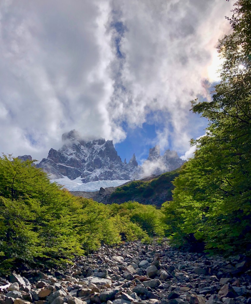
We ended up on a ridge looking at Cerro Castillo! Ugh. Back down, through the woods (this time we saw the marker) and a quick trip to see the lake and back to camp. The walk to the lake from El Bosque is really pretty past a stream and along some hills. You can look back down the valley as well.
At the camp the park ranger checked out ticket and wrote our ages and information on the back so on Day 3 we could take the emergency exit path if we decide to and we don’t have to pay again. He asks how old we are. (42 and 43). He is visibly shocked. “Why? You thought we were younger?,”we asked hopefully.
“No,”he says.
“Older?! Like 50?”we ask.
“Si,”he responds.
I was feeling a bit crushed, however my husband did point out everyone else was in the 20s so I did feel a bit better.
It was cold at El Bosque so we zipped together and we were super warm. The 20-somethings did not zip together and they were all saying they froze overnight. With age, comes experience!
Day 3
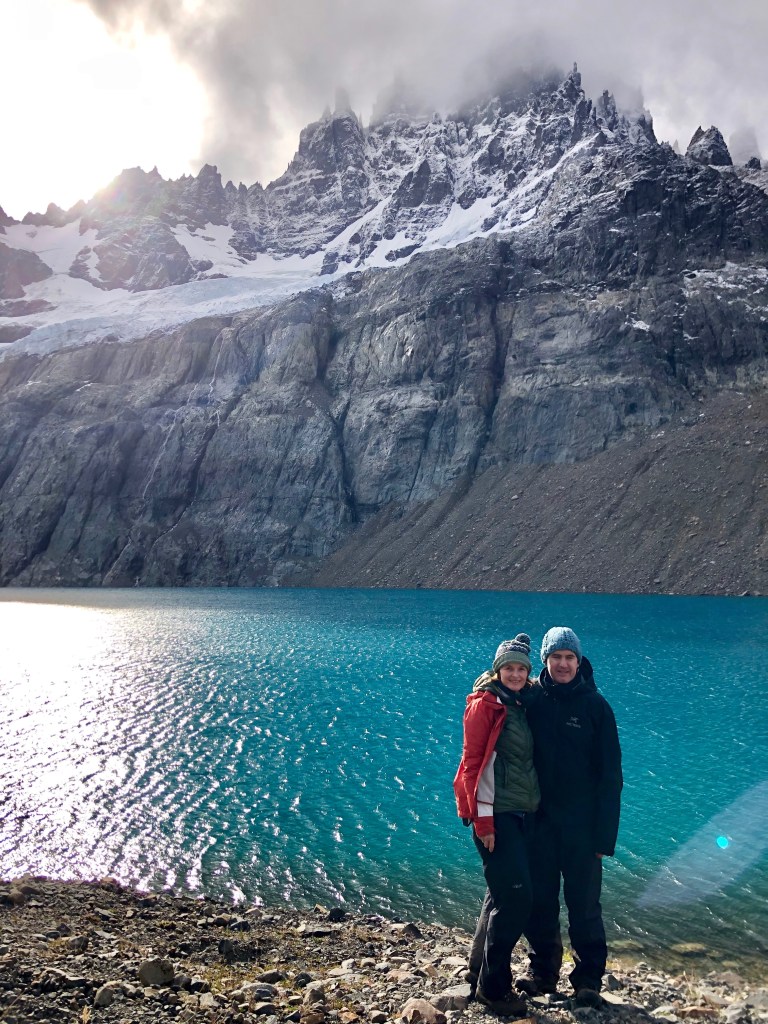
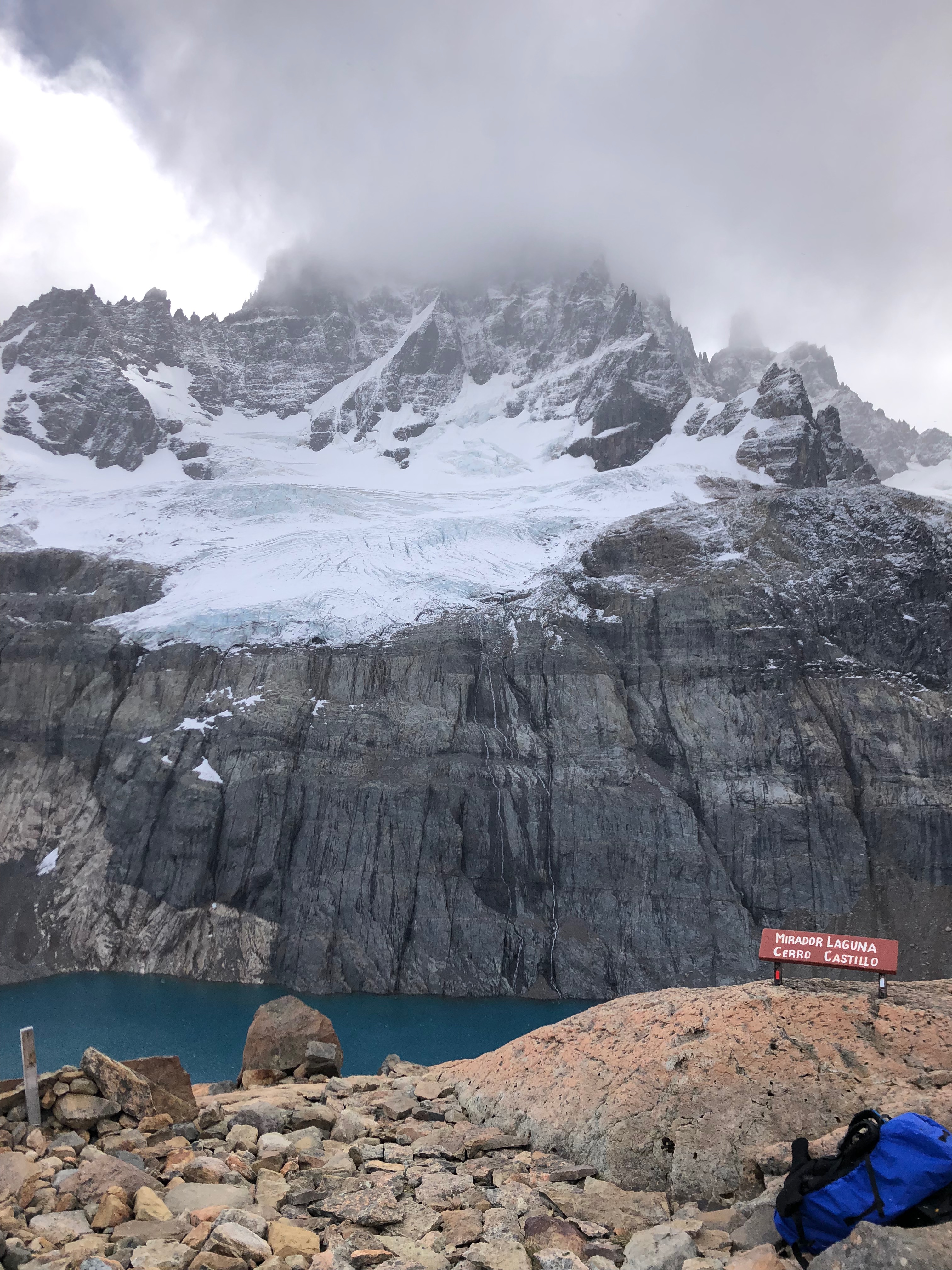
The next morning we packed up and the guide suggested we check out the the ‘secret laguna’ at the back. You basically walk behind the loo with a view, up over the ridge and across a field of rocks from an previous eruption, across a (melted) glacier field of rocks to the back of Cerro Castillo looking at Peñón. Turn around and look for the massive boulder so you know where to enter the woods when you come back. We went to the green lake and watched ice flows float around. Back to camp to start the last day of hiking. This side hike took about an hour and was well worth it.

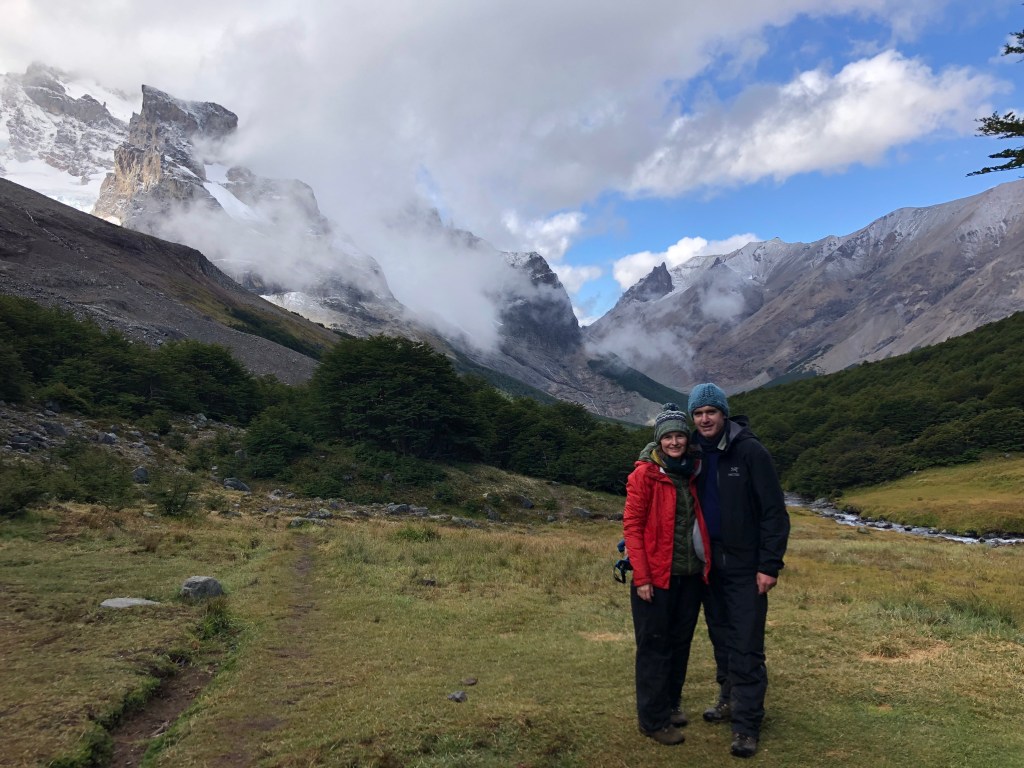
We walked up to Cerro Castillo and enjoyed some partially clear views.


We went down to the lake and took photos and then straight up to the Mirador. While we were at the Mirador I took off my mitts because I was hot and a massive gust of wind picked them up (they were behind a 8 foot tall rock) and blew them out to nowhere. We found one so I could alternate hands for the rest of our holidays.
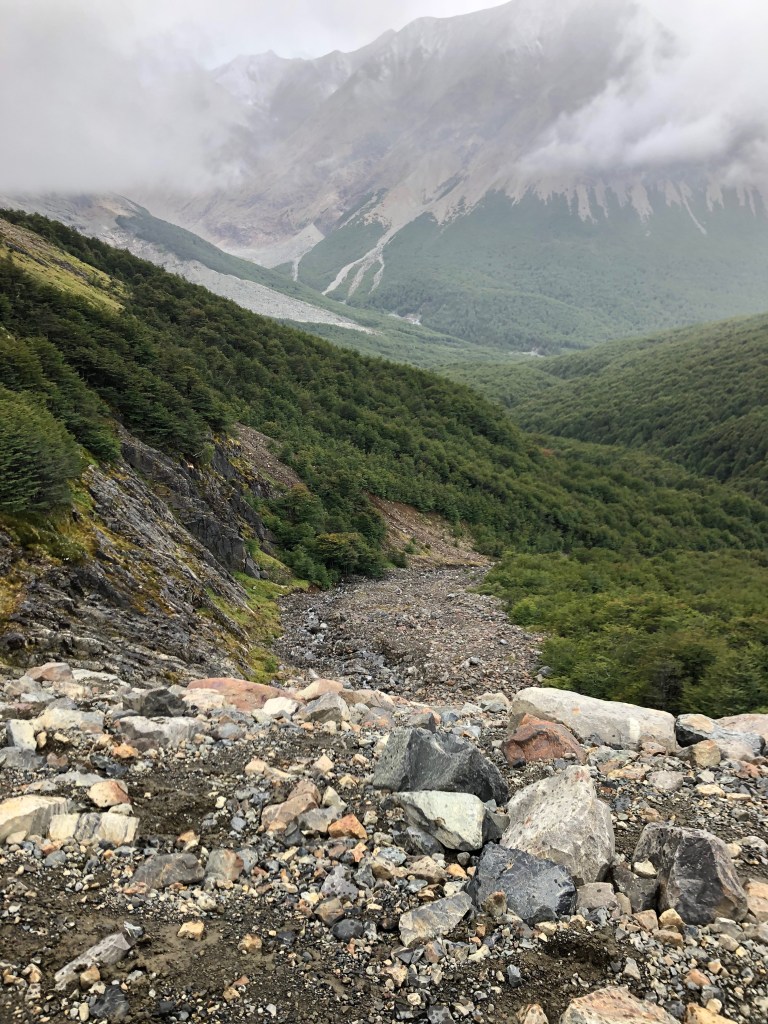
There are two routes down to Villa Cerro Castillo. One is to take the regular route which our friends did in November. She described it as ‘an obscene amount of rocks descending through scree and sharp rocks and it is quite steep… then the road back to town follows the river (although it’s far enough away that you can’t see the river) and it is quite dusty and boring.”
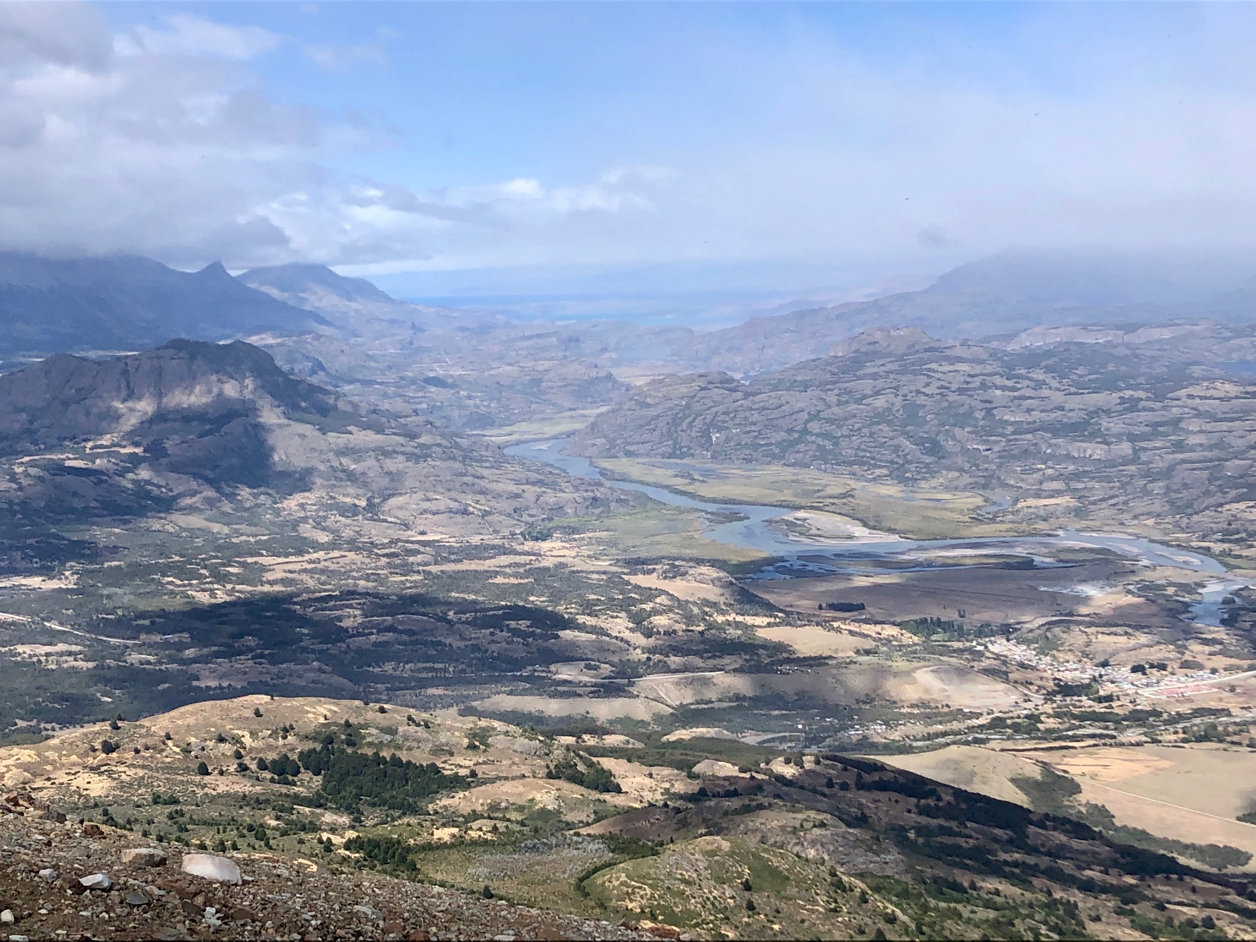
We took the Sendero Emergencia (emergency route) which is the day hike route from Villa Cerro Castillo up to the mirador. It was a great choice. Lots of rocks but the path winds down through them (at some points with a rope handrail!), then scrubby trees, then forest and finally a rocky farm road to town. It has gorgeous views all the way down. We called Clara at the mirador so she could estimate when to come and pick us up at the bottom. It was pretty dusty. But we had a gorgeous rainbow and views of the snow-capped Andes behind the winding river. A good promise for the next 20 years!


Clara met us and took us to our car and we went to a cabin we had rented from her for $50,000 / night (sleeps four). We enjoyed sunset views of Cerro Castillo. A nice supper in town at Puesto Huemul with great French fries and a sunset view of the peask. We bought provisions in town for the next day. You can use cash or credit card. Sweet Clara knew it was our anniversary and she had baked us a berry coffee cake for breakfast the next day and had left it in the cabin.

My husband had been wanting to spend our anniversary on the beach at a spa. And I did have to talk him into this more rustic trip. In the end he said he was really glad we did it (he had been concerned he would put his back out again, but thankfully he was healthy the whole trip). At the end of the trip I mentioned maybe we should do the Camino in Spain for our 25th. He was strangely quiet…..
Day or Long weekend options:
I think older children (maybe 7 years and up) could do the day hike from Villa Cerro Castillo on the emergency path up to the mirador. It would be a long, gorgeous day hike. You could have a lovely picnic lunch at the top. Hiking shoes are required.
We are considering having my husband hike the three day Cerro Castillo with our eldest and another dad/child friend. We think if you left Santiago on a Friday morning and did the first day hiking and emerged Sunday afternoon you could maybe even make the last flight out on the Sunday (if short on time) or at least take the first flight out on the Monday. With Clara and Frederico’s transfers and if all you are doing is Cerro Castillo, you won’t need to rent a car and deal with that hassle.
Week or longer options
We did this hike with a combined 10-day trip. Our itinerary was:
- Saturday – Monday hike Cerro Castillo two nights camping and one night in a cabin
- Tuesday drove to Puerto Tranquilo.
- Tuesday-Thursday we stayed in Puerto Tranquilo
- Friday-Saturday Caleta Tortel
- Saturday one night outside Cochrane
- Sunday fly back to Santiago.
You could drive all the way to where the Carerra Austral ends which is in O’Higgins. This takes much longer than what google will tell you. We didn’t do it as we didn’t have time and we wanted to spend more time seeing other things.
Car Rental
We rented with a family owned car company at the Balmaceda airport, called Traeger. They were really good and responsive and they were $200,000 CLP cheaper than Europcar for our 10 days. They wanted us to return it with a full tank of gas, but that meant driving past the airport and on to Coyhaique for gas and returning to airport (over an hour plus just to get gas) and we were running out of time so we filled up at the last station in Puerto Tranquilo and they charged us $20,000 CLP extra as the tank wasn’t completely full.
What to Pack
We estimated our three day hike (without going the long way down) was about 40 km total. My back was about 15 kg and my husband’s was about 20 kg with water as he carried the tent. I carried most of the food.
- One small tent and groundsheet
- Two sleeping bags
- Thermarest mats
- Everything was in wet/dry sacks
- Freeze dried suppers
- Lunch was sausage, cheese, bread, dried fruit and nuts, chocolate
- Protein bars
- Camping stove and one kettle that we used for everything. Next time my husband would like the luxury of a pot as well.
- Two mugs
- Cutlery
- Camelbacks
- hiking poles (have to be checked on the airplane, not allowed as carry-on)
- Long underwear
- Rapid dry trousers (wore one, packed one)
- Fleece
- Puffy coat
- Rain coat
- rain trousers
- Toque, mitts, neck buff
- 3 pairs of socks
- Sneakers for wet weather
- 2 long sleeved, one short sleeved one tank top
- headlamp
- first aid kit
- battery pack charger for camera phone
This is a comprehensive resource for the area of Aysen.

That is a plate of chips!!!
LikeLike
They were amazing! Especially after all that hiking!
LikeLike