There are many ways to hike the W in Torres del Paine, and planning a trek in the tumultuous year of 2020 meant we ended up booking it three ways. Learn from our plans on how to book the best trip for you.
First, you need to decide how you want to do it. Roughing It, High Comfort or Comfortable Hiking are just some of the ways we planned our W hike (details below). You can also book with a high-end hotel and do organised Day Hikes through the hotel. Or you can book whatever accommodation you would like and follow our hikes we did a year ago with grandparents and children under 10.
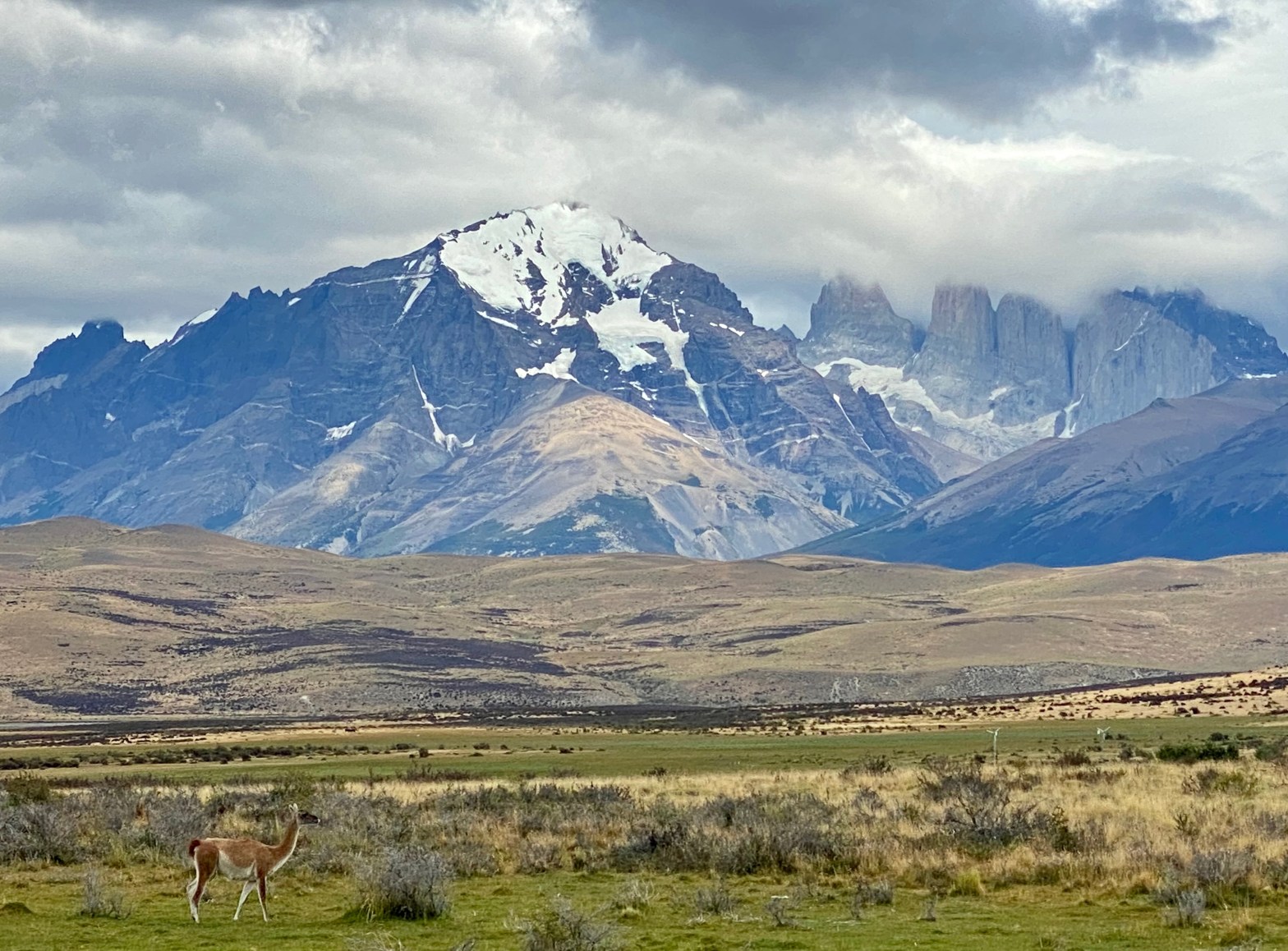
Then you need to decide which direction you want to do it. Looking at a map of the W you can either go West to East (left to right// counterclockwise) or the reverse. Although you can choose your direction for the W, for the O circuit you HAVE to go counterclockwise. For the W there are advantages to either direction. Most people go clockwise, (right to left) starting with the Towers and ending at Glacier Grey. We did it the opposite way. For us, we liked the direction we did for many reasons. We could let people by on the path but we didn’t have to try and pass or overtake many other people (which in a regular year with a lot of hikers on the trail would be annoying, we went in 2021 so had few people on the trail). The views were about the same both ways, except one day where we thought the views were better if you went clockwise. The wind is fierce in Patagonia and going the way we did it (based on the way the trees were leaning and how half their branches were gone due to wind) the wind is at your back. It also meant some of the longer trails with big packs were downhill and not up. And it meant ending with our goal of the Towers — a real jewel in the crown after all our walking.

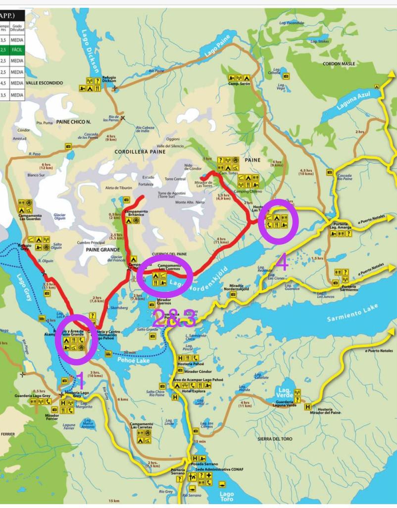
Accommodation on the W is managed by two separate companies. The first leg of the W on the left is run by Vértice Patagonia (Grey and Paine Grande sites for both refugios and camping). The rest of the W is managed by Las Torres previously known as Fantástico Sur (both names may appear on bookings and signage). You need to book via both independently. There is no free camping on the W. So study the map and distances and book based on your physical ability. If you want to see sunrise on the towers (sunrise between 6:30-7 am in summer) you need to book the Chileno Site. Otherwise, it’s up to your ability and their availability.
Due to Covid, we changed our plans three times and ended up booking all types and levels of accommodation and transport. I’ve outlined our three ways to book the W, followed by our detailed itinerary, packing list and maps at the end of this post.
Note: if you are traveling during times of Covid you will need to check which level (paso) your communa you are traveling from is in, which level Torres del Paine park is in, and depending on the levels you will need a permiso (at our time we needed just the C19) and we also needed a negative PCR test taken in advance of our trip. As rules are always changing please check the current rules before you travel.
Option: Luxury (we briefly considered doing this option when we thought lockdown would be lifted but maybe the campsites wouldn’t be open). You can do day hikes which are organised from some of the hotels in the park or even hotels in nearby Puerto Natales. Check out Hotel Lago Grey, Explora, EcoCamp, Las Torres, or the Singular. We have had friends go with these hotels and were very happy with their all-inclusive hikes/hotel packages. You could also book a hotel (like Hosteria Pehoe) and do day hikes using the Lago Grey ferry for the left side of the W, the Pehoe ferry for the second left leg and you can drive to the Las Torres far right side to do the far right leg to Base Torres. It’s very easy to do it all on your own as the trails are well marked. (In fact up until 30 min to boarding our ferry when we talked CONAF into giving us a map, we almost did the trail without a map.) I really like this website as a great starting point for researching accommodations. Just check on a map where they are located as some are in the park, and some are 1.5 hours away in Puerto Natales.
Option 1 : High Comfort March 2020
Originally when we planned the hike in Oct 2019 for March 2020 (with no pandemic as far as we knew on the horizon) we booked to do the hike staying every night in refugios. This meant we only had to carry clothes and we elected to take our own sleeping bags, but you could rent them too. We would sleep in bunk beds and have three meals provided by the refugios. We all had about 35L packs. We booked:
Day 1: Refugio Grey
Day 2: Refugio Paine Grande
Day 3: Refugio Frances
Day 4: Refugio Chileno
Day 5: Hotel in Puerta Natales: Remota Hotel
As we were going in March, only Punta Arenas airport was open so we would take the bus from Punta Arenas to the Pudeto ferry in the park. Then take the Pudeto ferry to Paine Grande campsite. Go up the left leg one day to Refugio Grey. Back down the next day to Paine Grande. From there head to Frances campsite (doing the middle leg of the W to Mirador Britanico along the way) then towards the Towers to stay at Chileno. Get up early in the morning to see sunrise on the towers, head back to Camping Central and the welcome centre and bus back to Puerto Natales, stay in Hotel Remota and then bus back to Punta Arenas the following day. This trip was going to be about $406,000 CLP ea for refugios and meals and $70,000 for airfare. About $12,000 to $20,000 per bus ticket (inside the park and to Punta Arenas). We were going to book with Bus Sur for our bus tickets.
Ten days before our hike, the country shut down due to Covid and we all went into quarantine.
In August of 2020 we were allowed to exercise to so we started a hiking club of like-minded women and did local 6 km hikes twice a week. In December of 2020 Santiago entered a phase in the quarantine where we could travel regionally, and fortunately Torres del Paine was at the same level and the park was now open again to travel. Within a week we had rebooked to do the trip for the middle of December 2020.
Option 2 : Roughing It December 2020
In early December 2020 all the refugios and meal plans were closed due to Covid, as well as most of the hotels. Information on the buses and ferries (actual availability on the days we needed) changed constantly. But we were determined!
We changed our booking from refugios to campsites. Armed with my four-person tent divided between the four of us, we packed our stoves, dehydrated food, sleeping bags and everything to be self-sufficient. The tricky part during the pandemic was accessing the trailheads. We booked:
Day 1 & 2: Paine Grande x 2
Day 3 & 4: Los Cuernos x 2
Day 5: Camping central /las Torres
Day 6: Hotel Lago Grey
We would fly into Punta Arenas and spend the first night at Paine Grande. Day 2 we would do the left leg to Refugio Grey. With two nights at Los Cuernos it would give us time to do Mirador Británico as a day trip on Day 4. And we would end with Base Torres.
One hotel was open in the park so we booked Hotel Lago Grey for our first and last nights. We would take the Lago Grey ferry (as opposed to the Pudeto one) from the Hotel Lago Grey across the lake to Refugio Grey to start the W going down to Paine Grande. We would rent a car from the extremely helpful Southland Rent a Car (993197838) and park it at hotel. If the ferry didn’t run (they would only run with more than 25 people and less than a certain number for Covid) we would park the car at the Sede Administrative CONAF guards hut and walk in 7 km to the left of Lake Pehoe and pop out at the Paine Grande campsite. We still hadn’t figured how to get back at the end of the W, but we were going to try and ask at hotel for a lift back once we checked in (as the bus wasn’t running). The man we spoke with at the car rental agency kindly agreed to buy us camping fuel for our stoves and matches as we couldn’t fly with them. We were all set to fly out December 12th. However on December 7th our part of the city went back into strict lockdown and we weren’t allowed to leave. Time to wait and make another plan.
Option 3: A Comfortable Hike February 2021
In February 2021 with Torres del Paine still accessible to travel, our areas of Santiago went out of strict lockdown and we were able to travel regionally to certain areas. By February 2nd were in full planning mode and this time we actually flew out on the 14th. We booked (and this time we did it!):
Day 1: Estancia Tercera Barranca
Day 2: Paine Grande campsite
Day 3: & 4: Los Cuernos x 2
Day 5: Camping Central / Las Torres
Day 6-7: Estancia Tercera Barranca
This time it was summer, so the Puerto Natales airport was open (it’s only open in Chilean summer, mid-Dec to early March) and it means it is only 1.5 hour drive to the park rather than the three hours from Punta Arenas. We changed our flights to Puerto Natales, and booked a transfer service with Onteaiken Patagonia to handle all our transfers (to/from airport, to trailhead, from trailhead at the end back to estancia). Onteaiken was really responsive before our trip, everything was handled on time without delay and the windows of this van were the cleanest we have ever seen! We could take photos right through the glass! Due to Covid half the hotels were closed or fully booked so we stayed at Estancia Tercera Barranca, which is located at the far right of the park (by the towers) in a gorgeous setting. Here is our full itinerary.
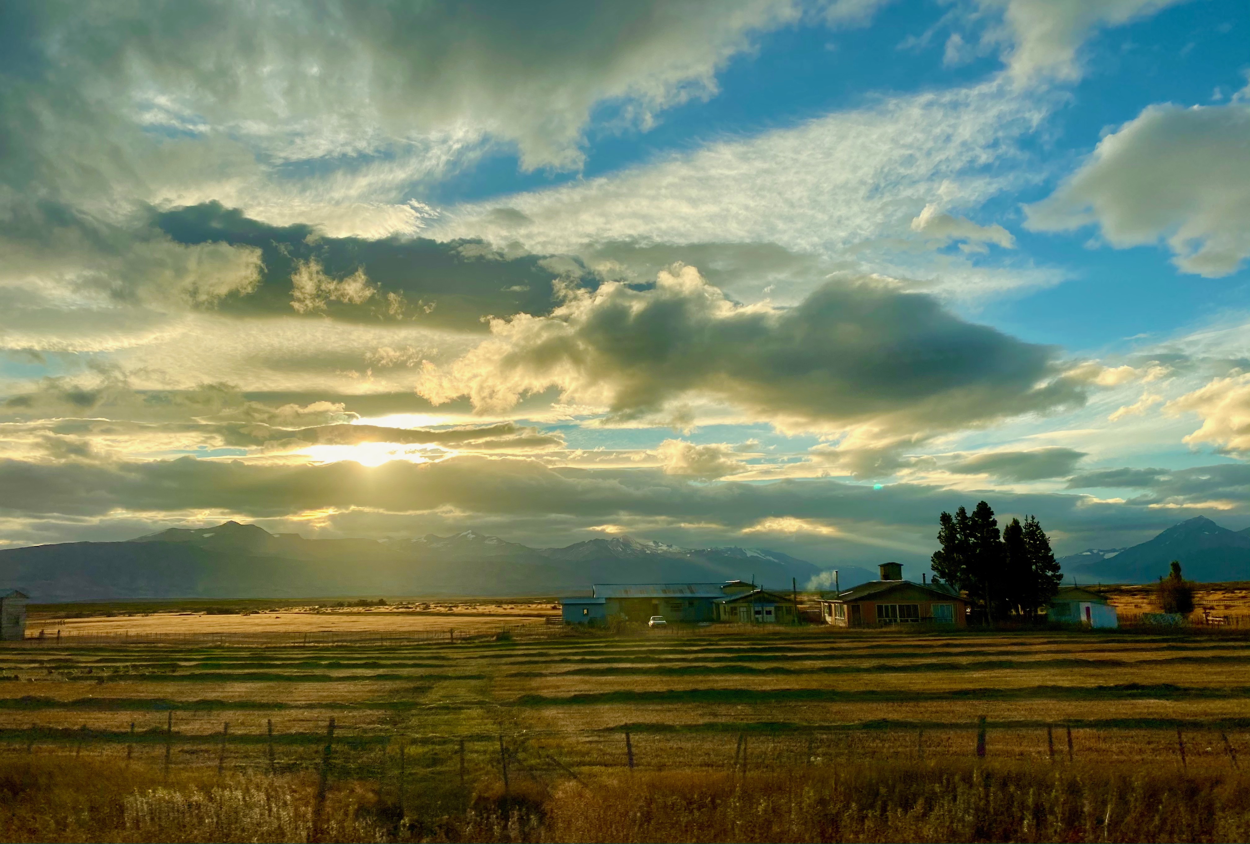
Day 1 Fly into Puerto Natales, Onteaiken Patagonia transport takes us to Estancia Tercera Barranca, an estancia on the edge of the park (1.5 to 1 hour to access trails in the park depending on which end of the park you go to), with the most comfortable beds and delicious food. They catered to our needs and we enjoyed sprawling out in their living room with a roaring fire at the end of our hike. The office staff were extremely helpful and responsive via WhatsApp leading up to the hike. They also have horses you can book with Oswaldo for half or multi-day excursions. We had BBQ’ed lamb and delicious vegetarian food as well. The views from the Estancia were incredible.
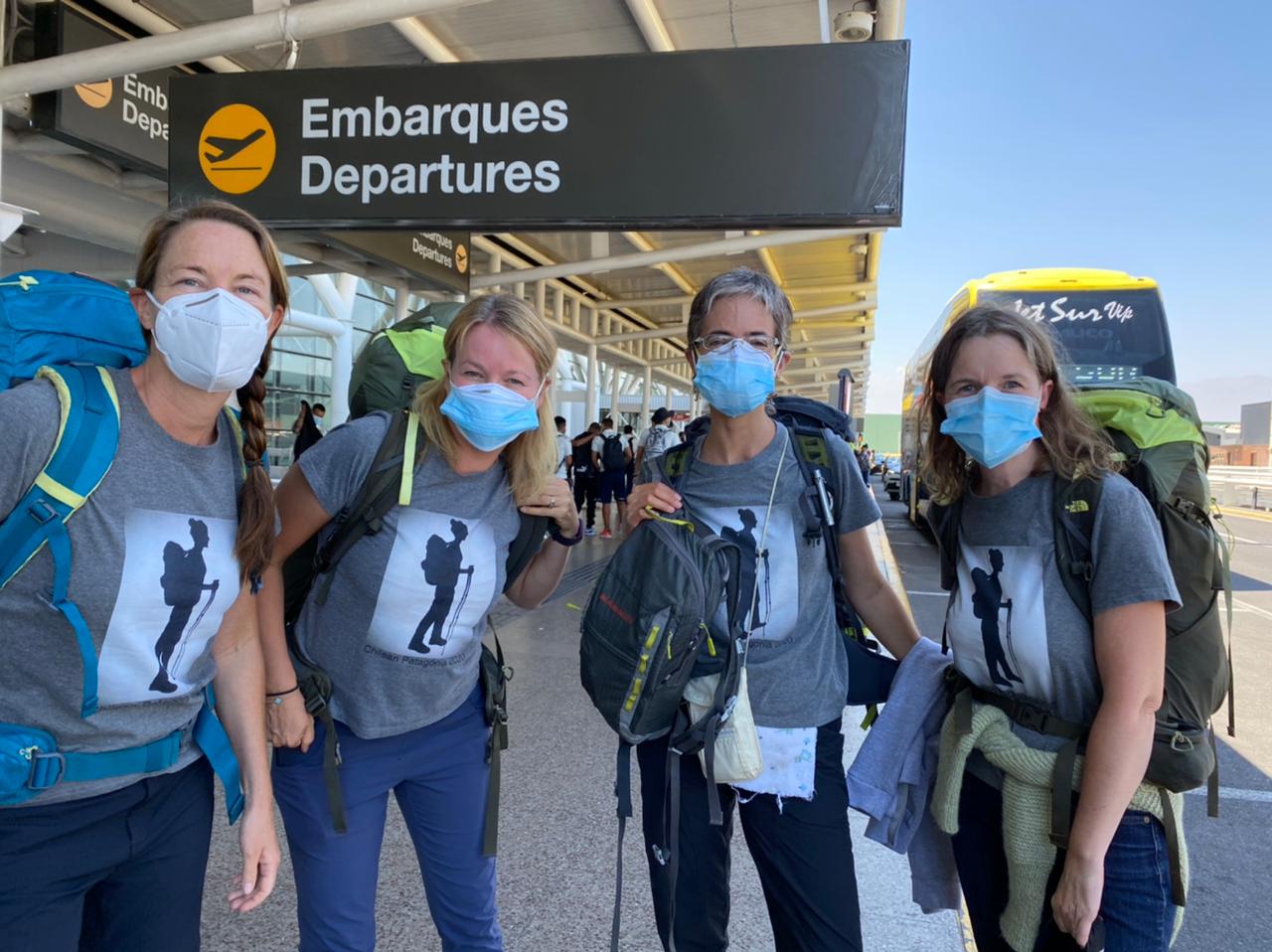
Finally at the airport and ready to go!


Day 2 A 6:30 a.m. transfer to Hotel Lago Grey, check in to the Grey Ferry boat at 9 a.m., drive to the trailhead and walk 40 min across the sand to the boat. Take the 10 a.m. ferry (one hour) to the trailhead. We walked up the hill to the Refugio Grey and campsite and left our big packs and organised a day pack. We were told there were lockers so we brought locks, but along the hike we actually just dumped our big packs under trees, beside buildings or under benches and they were fine.

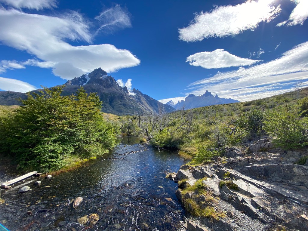
As we had beautiful weather we decided to add a few kilometres and go the left on the (well-marked) trail towards the suspension bridges (puentes colgantes) so we could get closer to the glacier. We got as far as the second bridge as the third bridge was closed during Covid. Adding the bridges was an extra 11 km round trip but totally worth it as the scenery was beautiful and the hike wasn’t hard. It would also be very doable if you were staying at a hotel and took the boat to do this section in-between ferry runs from Hotel Lago Grey. We left the boat at 11 a.m., we were having lunch at the second suspension bridge by 1 p.m. and back to Refugio Grey by 2:45 p.m.

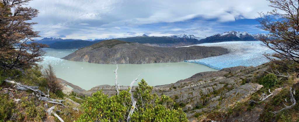
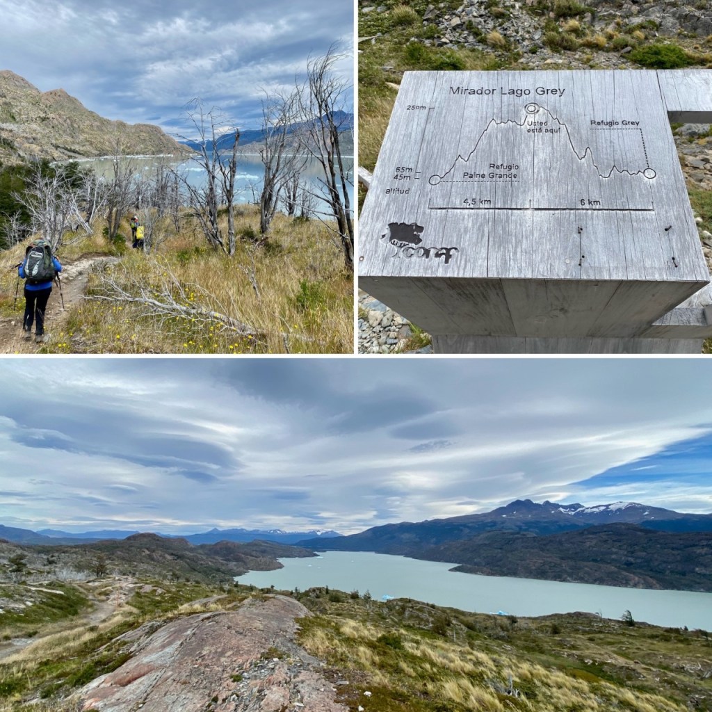
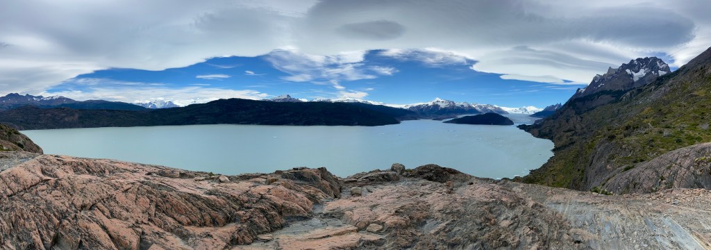
The refugio at Grey was really new, in the bathroom block there was toilet paper and soap. There was also a little store and an indoor kitchen. The store was well-stocked. We strapped on our big bags and started the hike to Paine Grande. It was a wonderful walk with the most incredible colours of blue sky, white pulled-cotton-candy clouds and putty-green lakes. We walked on rocky outcrops with condors soaring above us. We had to do a 250 metre incline up along a very steep cliff, and then down the other side. One of our group found this day the most difficult.

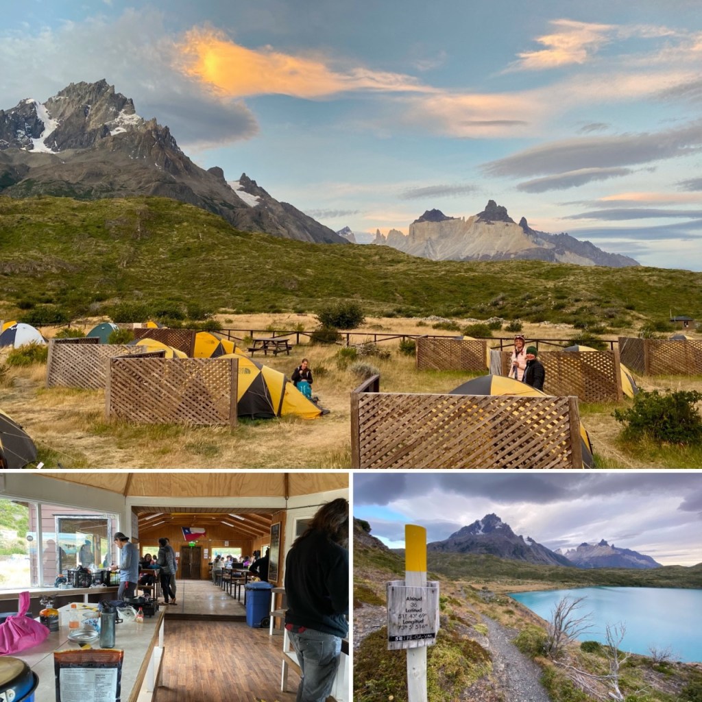
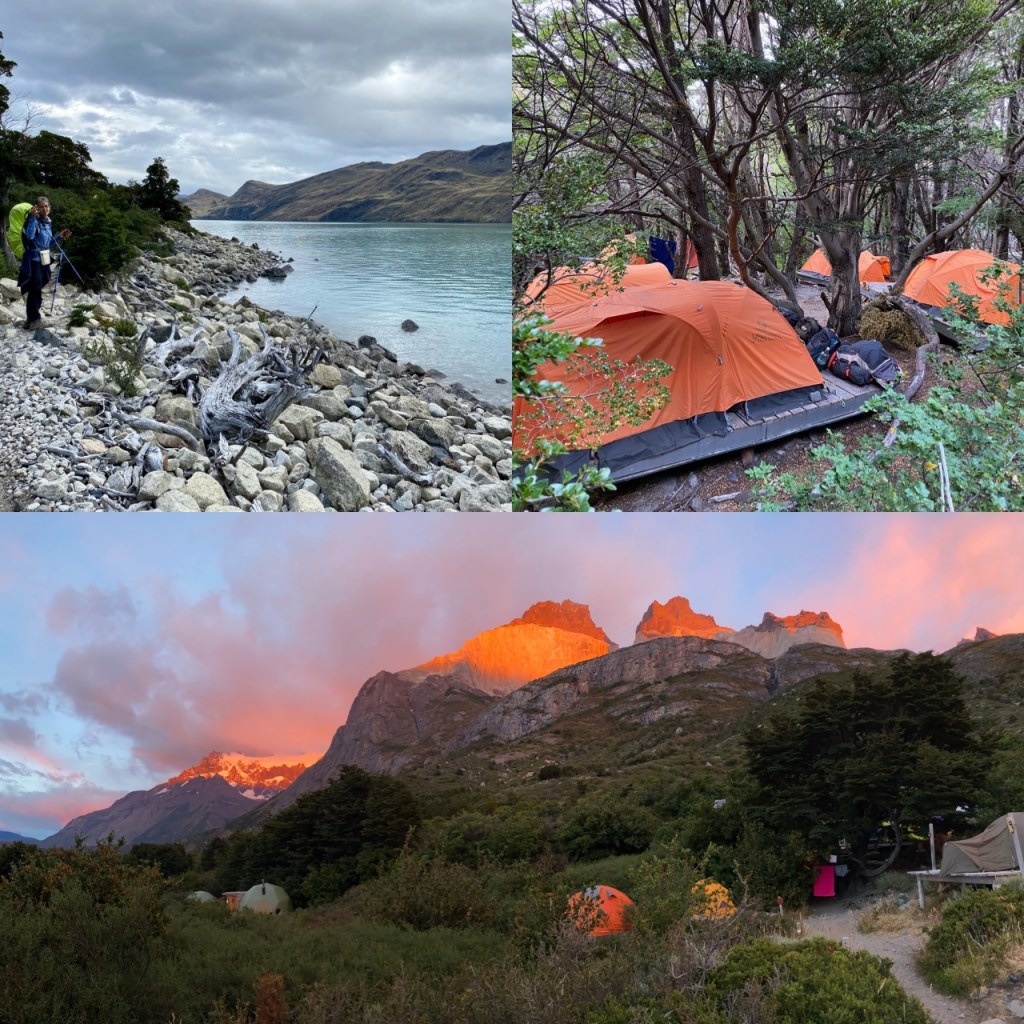
After almost 22 km we arrived at Paine Grande at 7:15 p.m. to a wonderful welcome. The manager of the campsite and shop gave us a hilarious introduction to the site and a former fireman easily lifted our packs (he deemed mine the heaviest!) and easily carried two at a time to our rented tents. We loved the location of this site under the creamy Cuernos and alongside the brightest blue lake of Pehoe. Also, the homemade bread might have had something to do with why we loved this site! The quincho (kitchen area) had one sink and many tables to eat at. There was electricity so we could plug in our phones/cameras. There was a big crate full of half used gas and leftover free give/take camping food. There is 3G entel mobile service on the edge of the lake. We had rented tents and mats and the tents were well-pegged and sturdy with wooden lattice wind breaks. The mats weren’t just thermarests but actual mattresses — thicker than a gym mat and covered in fabric, not plastic — so they were very comfortable. Walked from 11 a.m. to 7 p.m., 22 km.
Day 3 I was lying awake in the tent when I heard some very loud men say “Si, es hermoso!” So I thought I had better get up and see what was so beautiful. It was 6:30 a.m. and it was a gorgeous golden sunrise reflecting in the end in a ray of pink off the cuernos. Well worth getting up for! There is a hike just past the Pudeto ferry dock (this is the trail that would lead to the CONAF office which we thought we might have to do the second time we booked our trip.) The man in front of me who set off at quick pace at 6:30 a.m. told me there was a nice mirador an hour away, but I was content with the hill overlooking the campsite and Cuernos.


We set off about 11 a.m. and headed towards the second campsite, Los Cuernos. Before we left we heard from a group of spry young 20-somethings (we nicknamed them The Chicos as they were a group of friends and cousins doing the W together) that they were also headed same way but were leaving earlier to do Mirador Britanico along the way as the day was supposed to be nicer than the next. Which got us thinking about doing the same thing even though we were heading out later.
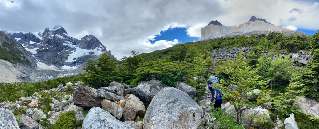
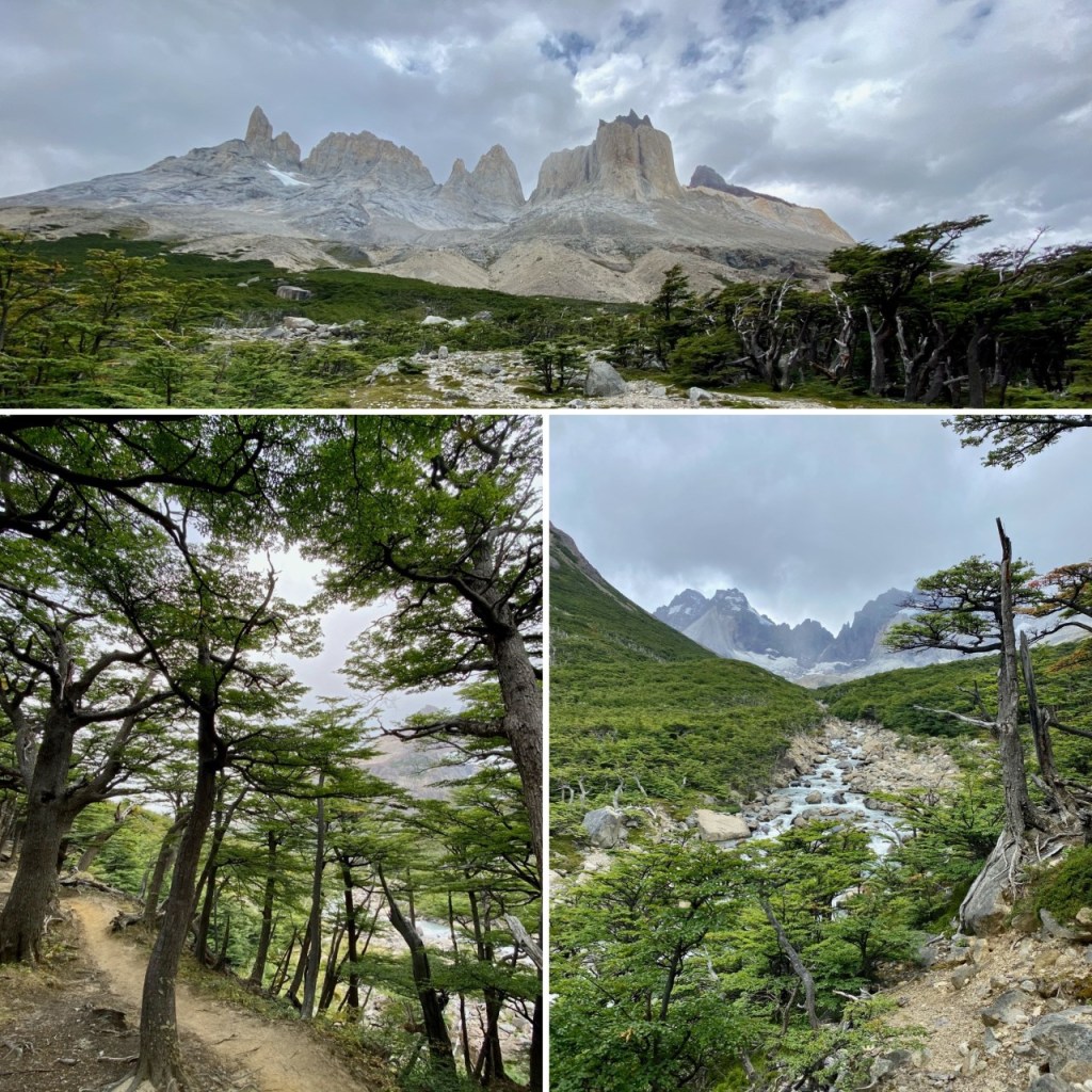
The hike followed lakes with views of the Cuernos (horns) and a burned out forest and a real one, along a river and towards a swing bridge of one person at a time. We were glad there weren’t more people on the trail or the wait times could be very long! We arrived at about 2 p.m. and dumped our gear on the other side of the bridge at the (empty) CONAF office, had lunch and took a vote. Do we do the mirador or risk the weather the next day? It was 2:1 with 1 absentee ballot cast so we all decided to not go all the way, but just to Frances lookout. After another gourmet lunch of protein bars and the ever-present trail mix of nuts we headed up Valle Fances. We had a good view (no blue skies but no rain) and then we headed back down. By the time we reached our packs my ankle felt odd, another friend needed a leg stretch and I had a Swedish massage (from our Swedish friend in our foursome). We were up to Mirador Frances by 3:30 and back down by 4:15 p.m.

We loaded up our packs and headed to the campsite. We passed the Italiano campsite which was closed but is in a great location and the Frances campsite as well which is along a river in the woods. An hour after Frances (and about an hour before Cuernos) there is a flat part of the trail where we had 3G entel mobile service. There is a rather steep section (going down for us) and then the trail ended by walking on stones along the lake, through a small woods over a river and small waterfall and towards the campsite. By 7 p.m. we knew we were close when we heard the pan flute and saw raised orange tents in the woods. I thought we would be greeted by Ewoks but instead we had a cold coke and the best news ever. They couldn’t find our reservation for tents for the next two nights, they were fully booked with about 100 people so would we mind sleeping in bunk beds in a dome? Our tired mid-40-year old bones were very grateful!
The Cuernos campsite had a smaller quincho but still had a give-away desk with half-used gas and some food. There were one or two plugs for your phones. The smaller shop had dehydrated food bags, gas canisters for sale, pop and alcoholic drinks as well as lots of cookies. After having walked 19 km we gratefully sank into our bunk beds. Walked 11 a.m. to 7 p.m., 19 km
This was the hardest day for me as my bag was pressing on my collarbones and my ankle was starting to feel sore.

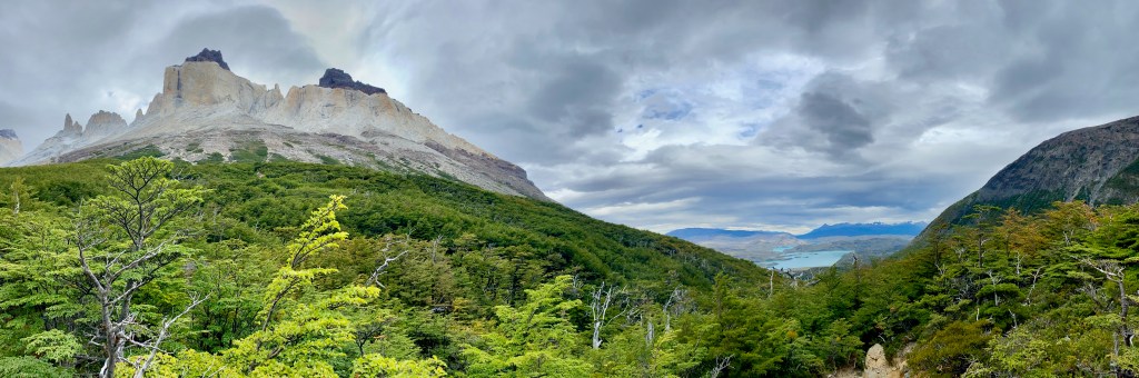
Day 4 We were treated a flaming orange sunrise beaming off the Cuernos as we were making our oatmeal before 7 a.m. We had read the weather was going to be ok so we decided to go back to Valle Frances and do the whole hike up to Mirador Britanico. We backtracked to the Valley and this time went all the way up to the top. It is an incline all the way, through rocks, forests, over huge swaths of rocky flat parts and then a scramble at the end to the top. We had a very foggy view at the mirador. My husband and I had hiked the W back when we were in our 20s and I do love this top bit. It feels like you are so small in the middle of an amphitheatre of mountains all rising upwards for their performance and you stand as the small onlooker in the midst of them. Then comes the sound of the wind, the answer and call of the avalanches and the views out to the green lakes beyond. Even in spitting rain it is awe-inspiring, especially after a hard slog up to the top. (Of course, going down is worse.) And we had blue sky by the time we reached Italiano campsite, naturally!!! After 24 km and over 40,000 steps we were happy to see our domo. Walked 8:20 a.m. to 6:40 p.m. (CONAF office by swinging bridge at 10:20/ Mirador Frances at 11:20 / Mirador Britanico at 1 p.m. (lunch) / CONAF office at 4 p.m. / Cuernos at 6:40 p.m.)


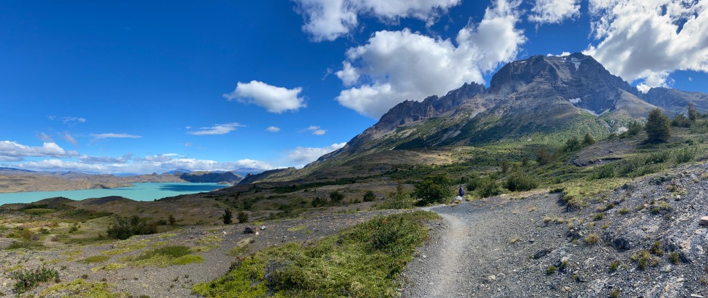
Day 5 We packed everything up and headed out for Las Torres/Camping Central campsite. We saw the cute little Cuernos cabins as we left, and began a very undulating walk with the Cuernos at our back, crystal green lakes on the right, condors overhead, and in the end a sloping section down to the flats of our next campsite. Going in this direction meant there wasn’t much of an uphill for us and the wind was at our backs. One of us had a crooked bag and so found this section the worse. Of course probably not as bad as the couple we saw along the way who decided to hike the trail carrying a shared duffle bag between them. We are curious to know if they are still together when they reach Lago Grey!!


When we got to camp my ankle was also worse. Thankfully there was a food truck! Glory be! We rested in the sun and then ordered big fat sandwiches and then, (in what we thought was a rather inspired move) we went back and ordered another round of sandwiches to take with us the next day for lunch. This was the least well-equipped campsite in terms of the fact the quincho was a tent, there wasn’t a lot of gas left behind nor food from previous campers (due to the fact this is usually the first campsite for most hikers). Every other campsite also had fresh eggs for sale, I didn’t see any eggs at this campsite but I did see my favourite gin made in Patagonia, Last Hope! However in normal times there is a gorgeous huge hotel (Las Torres) and a refugio which I noticed had big draft beer tanks and a common room. There is no mobile reception here. We enjoyed a beautiful pink sunset reflecting off the towers! Be sure to walk towards the hotel to get a better view of the sunset. My poor foot prevented me from doing more than hobbling around and hoping I could do Base Torres the next day. Walked from 11 a.m. to 3:30 p.m., 15 km.

Day 6 We got up fairly early and left by 7:30 a.m. (To see the sunrise at the base of the Towers from this campsite in February you would need to get up and leave around 2:30 a.m. and take headlamps, we all thought it would be a scary walk as there is a long section along a gorge.) You walk along the flats and then start zig zagging your way up some rocky scree to the top. (Where you see the sign “Windy Pass”there is 4G mobile Entel service.) Then we walked along the gorge with a river below, crossed the bridge, and up through a shady forest. We came across the Chileno campsite which would be gorgeous to camp at and make accessing the towers for sunrise much more doable. Sadly, it was closed during the pandemic.
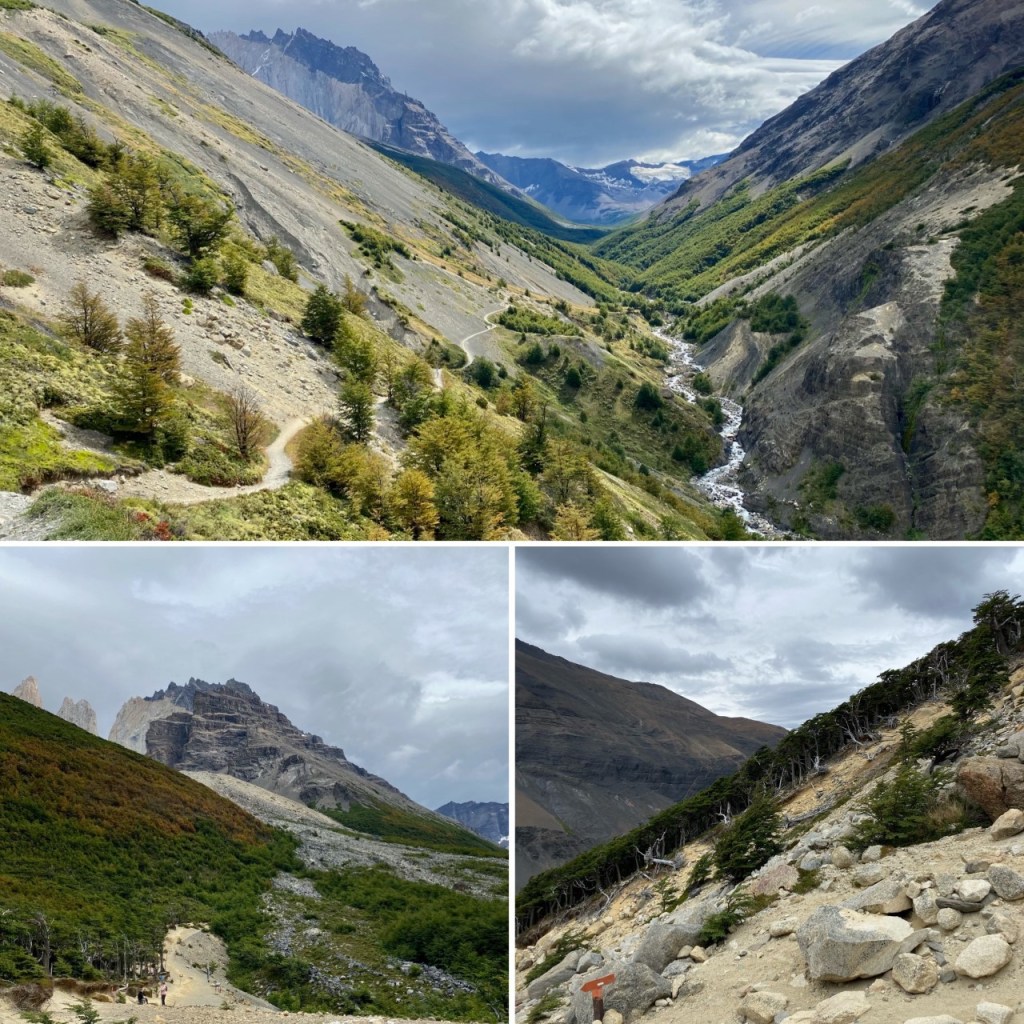


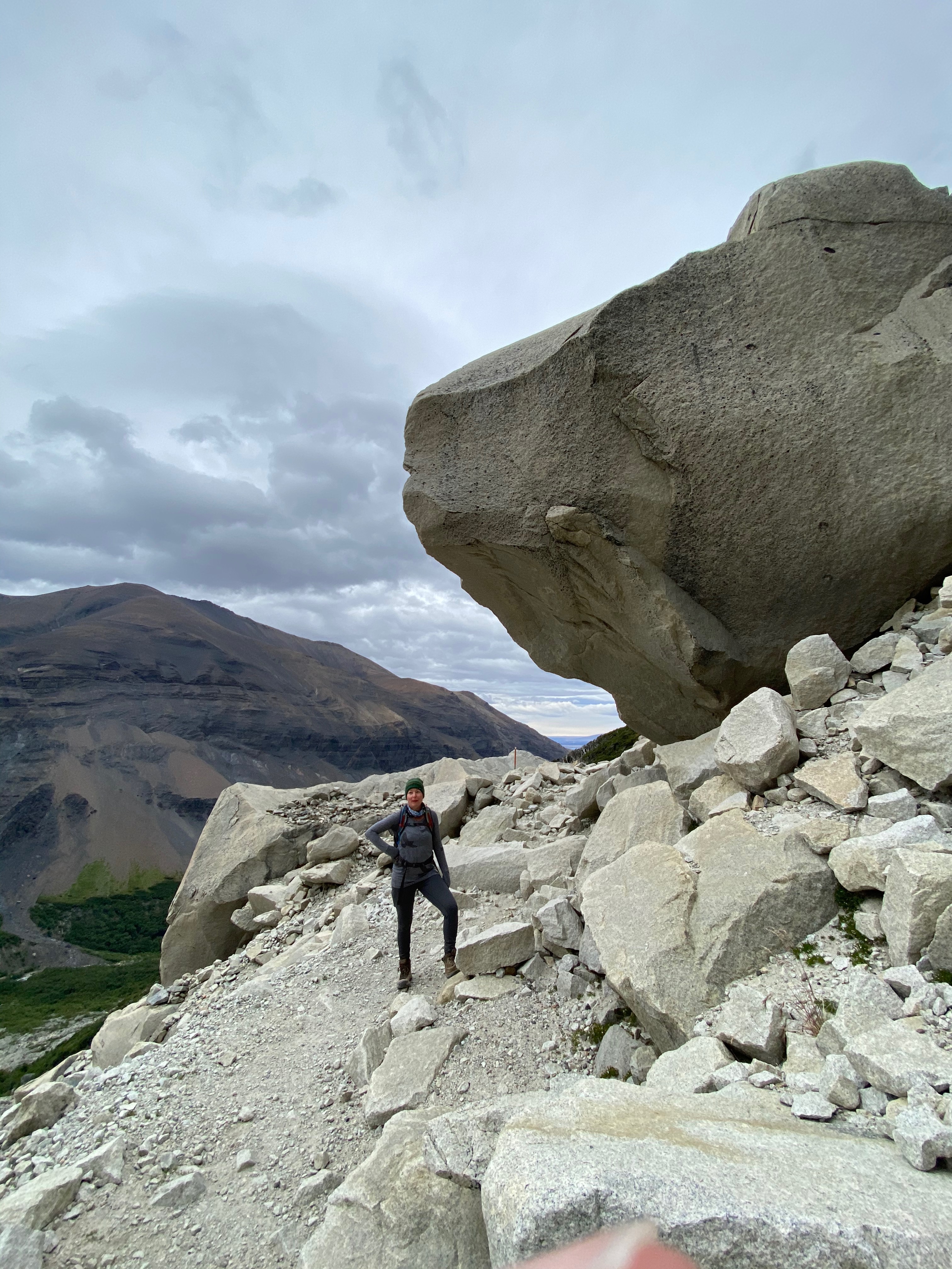

After another forest walk we popped out at a rather bare area, (there are outhouses here) and then began the traverse up through big boulders. We thought it would be straight up but I was a very slow back and forth path and not too bad. We were surrounded by clouds but when we got to the top we were rewarded with a rare treat that the towers, though surrounded by fog, were actually visible.

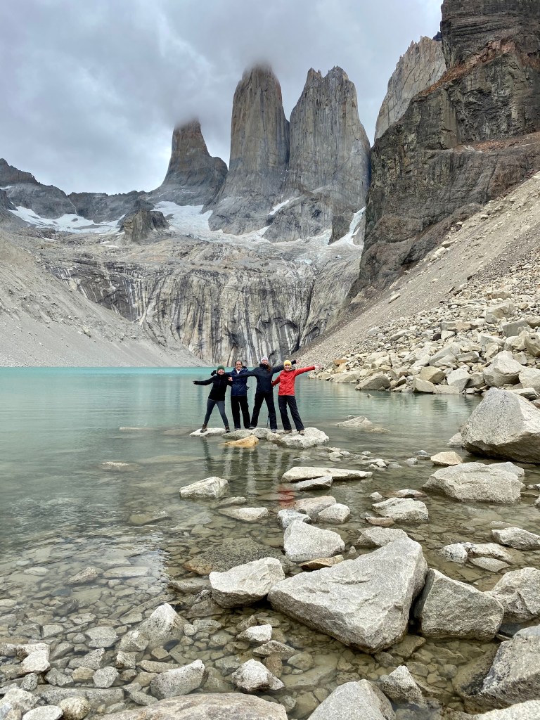
In regular times there are about 1,500 people on the path so it would be advisable to go early to avoid them. There was six of us at the top and we probably passed about 50 people on our way down. We spent a windy and cold hour at the top having our food truck sandwiches. None of us found this portion very onerous but we had been hiking a few times a week for the past six months. In fact we all felt really good afterwards and no one had sore legs or muscles. A testament to practice and training! This hike took almost 24.5 km to do. We had our driver meet us late afternoon at the (closed) Welcome Centre to take us back to the Estancia. Walked 7:30 to 4 p.m. with 1.5 hr break, 24.5 km
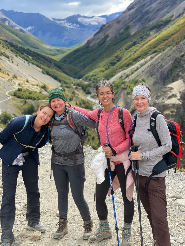
The provided map indicates hours between sites, not kilometres. We don’t really know why, maybe because you normally could walk a more brisk pace without a huge pack. We found the hours on the map to be accurate, we maybe took an extra half hour here and there, but we did stop a lot for photos and pee breaks (with ten kids between us there were a lot of pee breaks!) And then other times we had a quicker pace than listed. Overall we walked 183,081 steps, 104 km and spent five days on the trail. We learned about ourselves, our capabilities and strength to power through neck, back and ankle pain, but more importantly we shared our stories — past experiences and future dreams. Oh the conversations those hills and trees could tell of all the people who passed them by. We loved our little UN group from four countries; Sweden, Ireland, Colombia (who was very determined to book our campsites and without her this trip wouldn’t have happened!) and Canada.
Day 7 A day of reading books, sharing photos, self-lead group yoga, a scramble of a hill to find 4G service (how would we go a day without hiking?!) and a bit of rest for my very swollen ankle (which upon return to Santiago I would find out I had done something to my achilles tendon and had to rest with physio for a month!)
Day 8 We began with a five hour horseback ride with Oswaldo, organised through the Estancia, with very calm horses to a beautiful view (ours was shrouded in fog) and back to the Estancia for lunch and then to Puerto Natales to fly home.
In the end our cost was $680,000 CLP per person (based on double occupancy and four to a van). This includes flights, all our ground transfers, the campsites, the rented tents and mats, the park fee, the estancia accommodation and camping fulel. The meals (supper was $20,000 pp at the Estancia) and the horses ($25,000) were extra. This doesn’t include meals on the trail which were essential oatmeal, trail mix, protein bars, snickers and dehydrated pouch suppers. YUM!
We all agreed we might not have needed all we packed, but you do have to be prepared so there was really nothing we could have left out. One of our group thought maybe we could make the hot dehydrated meals for lunch and it would have been more filling for the hike. I didn’t need the (very light) water filters I had brought as there is so much water on the trail and the walks weren’t long enough for us to need more than two litres of water anyway. I wish I had had flip flops. Good thing I have a friend who lent me hers!
We did one checked bag on the flight for our hiking poles and misc items like swiss army knife, but we did notice other hikers were allowed on the flight with hiking poles.


Such beautiful photos! Gosh I loved my hike here! No food truck for me though!!
LikeLike
We were so shocked to see the food truck! It felt like a mirage after all those days of walking 🙂
LikeLiked by 1 person
Just spent an hour enjoying your trip!! What an accomplishment to plan it, let alone to do it! Besides being so happy ayou were able to go, you should be really proud of completing such a vigorous hike. You pictures are outstanding!
>
LikeLike
What an incredible trip! Best hiking trip ever! Thanks so much, Sarah-Lee, for making it happen, keeping track of everything, writing it all up, and taking spectacular photos! You are the best.
LikeLike
❤️❤️❤️❤️
LikeLike