
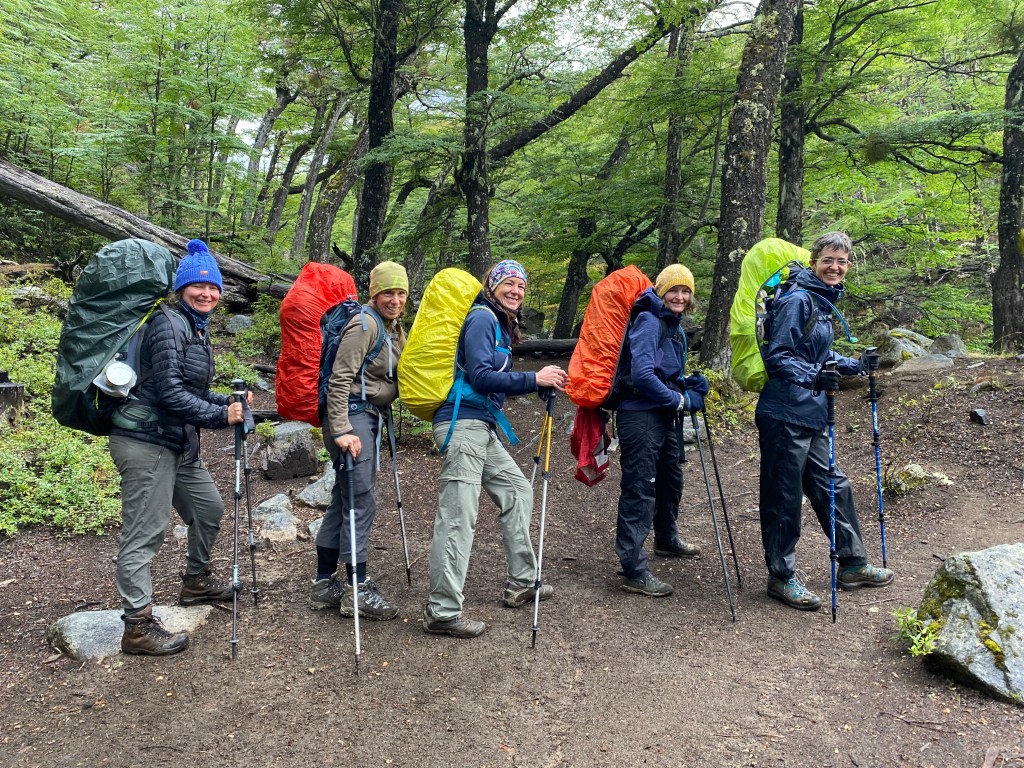
Aysen, Chile is an area that once you visit, it’s hard to let it go. Which is why, when my girlfriends suggested another Traveling Spouses trek — but this time to Cerro Castillo — I immediately agreed and booked a flight from Mexico to join them! This time we were five people — hikers on the trail called us the United Nations with Sweden, Colombia, Ireland and two Canadians. Our Colombian friend flew in from the US and our little gang was complete. (Our first hike was the W in Torres del Paine which you can read about here.)
Day 1: We booked the first flight out at 7 a.m. and arrived in Balmaceda at 10 a.m. Pierre and Stephanie from Aysen Travel Lab picked us up and drove us the 30 minutes to the trailhead. They also had gas canisters and matches for us. We re-organized our stuff, added more suncream as it was a beautifully hot, sunny day, and one of us scarfed down a salad! We walked about 20 minutes along the trail and then reached the guard hut. We signed in (and noted everyone else ahead of us was in their 20s!) We dutifully added our GenX ages, got a map and listened to the trail advice. Which was to pack up and start hiking every day by 7:30 a.m. to reach the passes before the wind, watch out for the jabali (wild boar) and pack out all our garbage. We paid our entrance fees ($23,000 for residents and $29,000 for tourists).

It was such a treat to do this hike again, my husband and I had hiked it a few years before, but the second pass was closed at that time due to weather. This is a frequent occurrence so make sure you have back-up plans. We had also done day one under cloud so it was so nice to have a sunny day with views of Cerro Castillo the whole way. We left the guards around noon, we had a few river crossings so we were glad for our water shoes, and we had a nice lunch in the shade. The first day is very flat and easy. We arrived to the entrance sign and old guard hut around 4:30 p.m. and were at the campsite Rio Turbio just after 5 p.m.
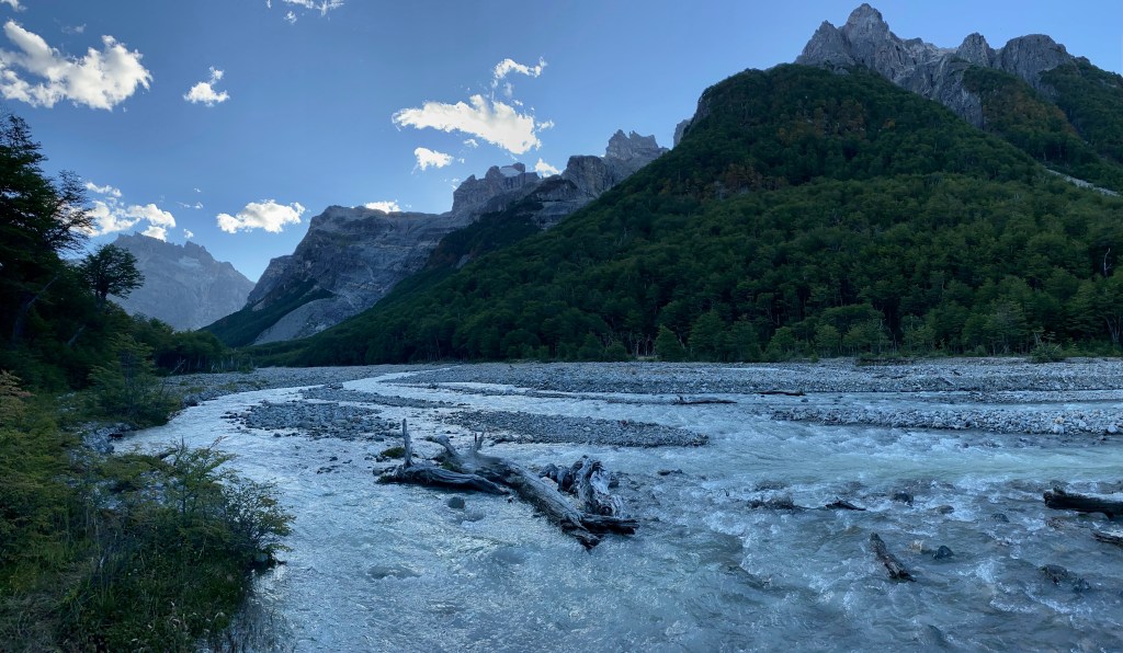
There is an outhouse (it was full and foul) so we used the old single pit-like outhouse which was missing a wall as it was much nicer. There are a few picnic tables, cows walking through the campsite and a river which has a lot of sediment. We used a water filter for drinking this water but otherwise we didn’t need the filter as there are clear streams and rivers the whole way. The first day was 15.5 km of flat walking.

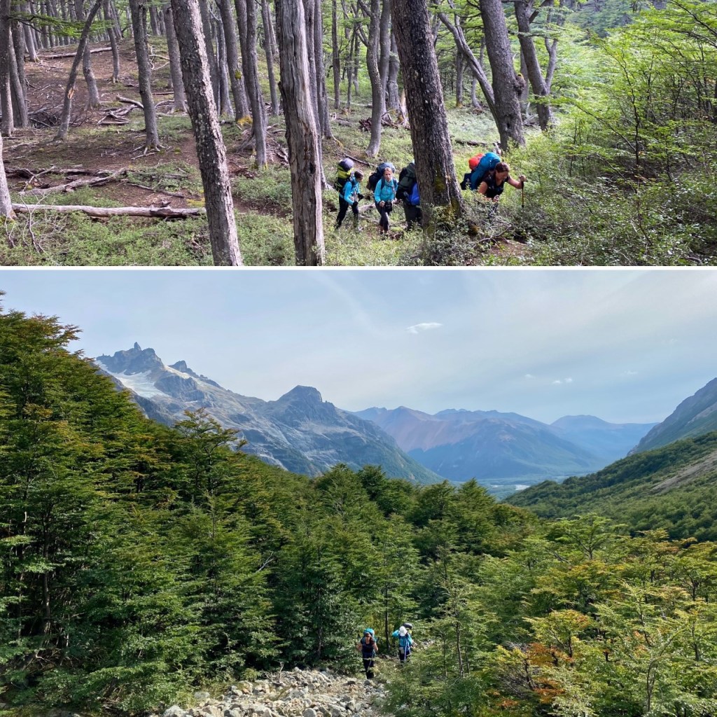
Day 2: We really didn’t think we needed to leave by 7 a.m. so instead we left the campsite by 8:30 a.m. and for our speed of walking this was fine. The last time I did this hike we had snow on the pass so I was glad to see we had much better weather this time around! We walked straight up for a good hour through the woods. We passed a group of 20 year olds who shouted to us that we were “muy secas!” We did notice the night before they were carrying a litre of olive oil and a 500 g jar of Parmesan cheese so perhaps our speed was due to our lightweight packing prowess!
Pass Peñon (2416m) is a lot of large stones that you have to pick your way up to the top, there are some yellow markers and red and white paint smudges to help guide you, sometimes there was some crawling involved. We got to the top before the recommended time of 11 a.m. (due to wind in the afternoon).

We had a nice lunch and photo op at the top and then headed down. There is a switchback trail all the way down, with views of skinny waterfalls and the valley below. At this point you are headed towards the grove of trees to the left of the stream/river. The river crossings here have planks and bridges so we didn’t need to take off our shoes. There is more uphill into the woods and across a dry river bed and you end up at El Bosque campsite which is up on the ridge.

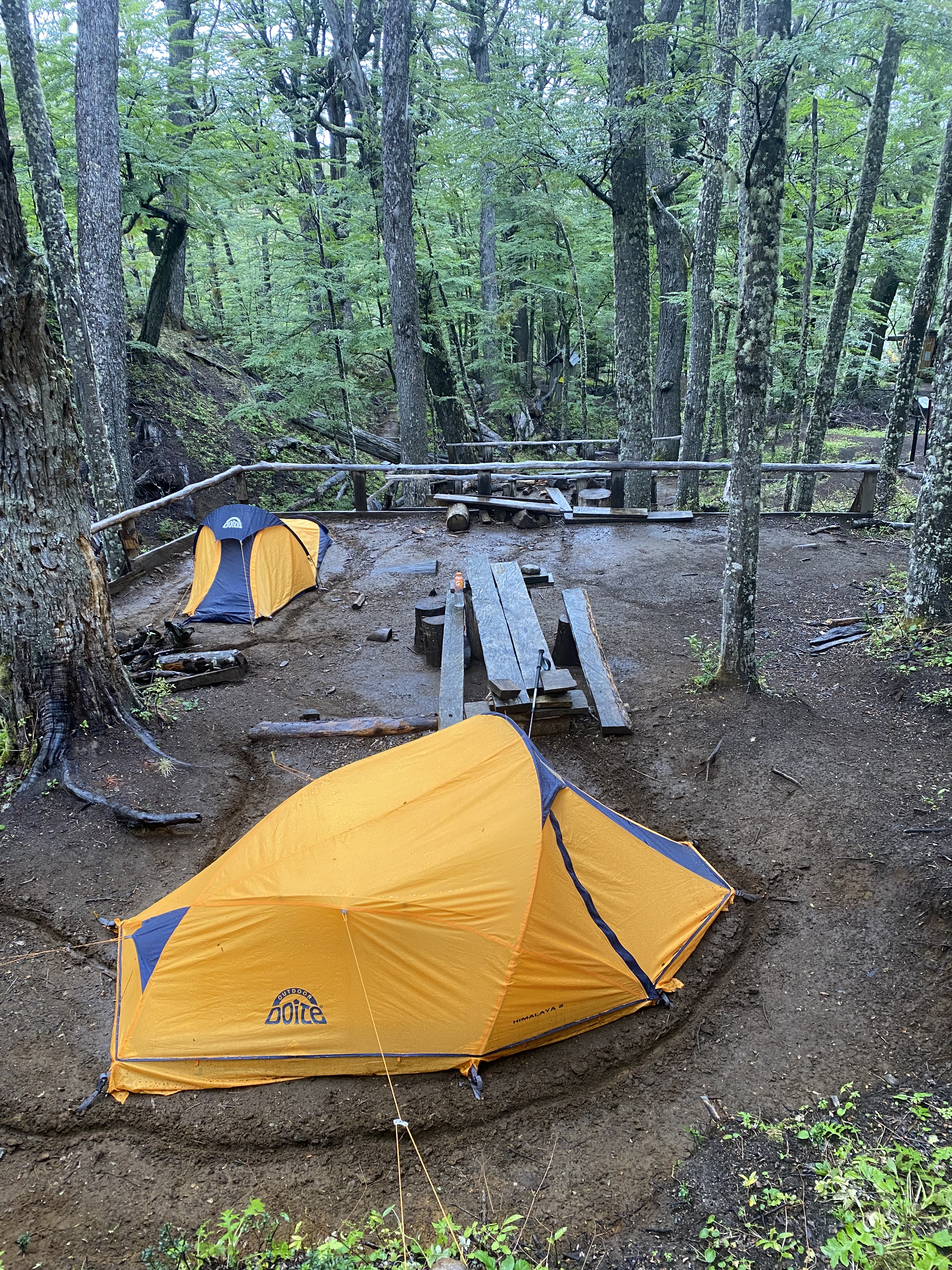
The last time we camped here there was a park ranger, but not this time. We arrived at El Bosque campsite at 2 p.m., had a cup of tea, set up the tents and then did the side hike to Laguna Tempano (go back up behind the wooden outhouse and you will see the trail). They have expanded this campsite since I was last here and there are extra, flatter sites a bit beyond the first ones you come to. So take a walk around. The water is here is easily accessible and no need for a filter.
We did the side hike to Laguna Tempano from 3:30 p.m. and arrived back at 5:45 after a lot of photos down by the green glacial lake. There are a few scant bars of service so we sent a text to the husbands to tell them we were alive. 14 km and 156 floors for day two.

El Bosque campsite 
Behind El Bosque on the side hike 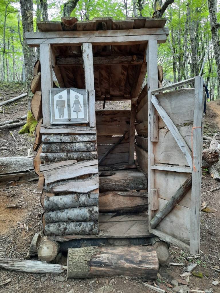
Outhouse at El Bosque 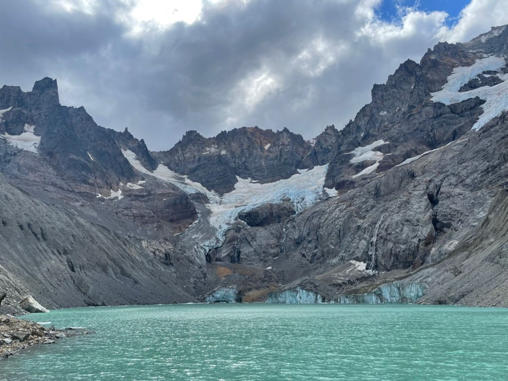
Side hike to Laguna Tempano
Day 3: Again we left at 8:30 a.m. we knew we needed to hit Morro Negro Pass (1689m) before 11 a.m. due to the wind and weather. When my husband and I were here the pass was closed and we hiked out after Cerro Castillo lake via the day hike /emergency exit. So this is also a shorter option. There is some uphill through woods, and then you come out into a valley along a stream with views behind you to the valley. Cross over the stream and you are down by the lake and you have arrived! We were at the lake within an hour of leaving camp. Photos and snacks and a view of a rainbow and we were off again.


From the bottom of the lake you have to look very carefully for the yellow markers. There isn’t much of a path, you pretty much just slowly wind your way up. If you are going to do the day hike/emergency exit out and head back towards town, you go towards your left and if you are carrying on to the next campsite you go towards your right to the nub of a hill which looks pretty innocent. Until you are arrive at the top! On the way up the rocks and boulders do give way to an upwards switchback trail.

At the top we were nearly blown over a few times and a friend had to chase a rain cover that got blown off. The winds were really fierce. We were headed down the other side by noon. The other side is worse as you are going down, there is no path to speak of and winds would come in massive gusts. I felt like I was in Cape Breton or Peggy’s Cove, so incredibly windy. We were out of the wind and in the treeline by 1 p.m. The sun popped out in time for lunch and for us to take off wind and rain gear.

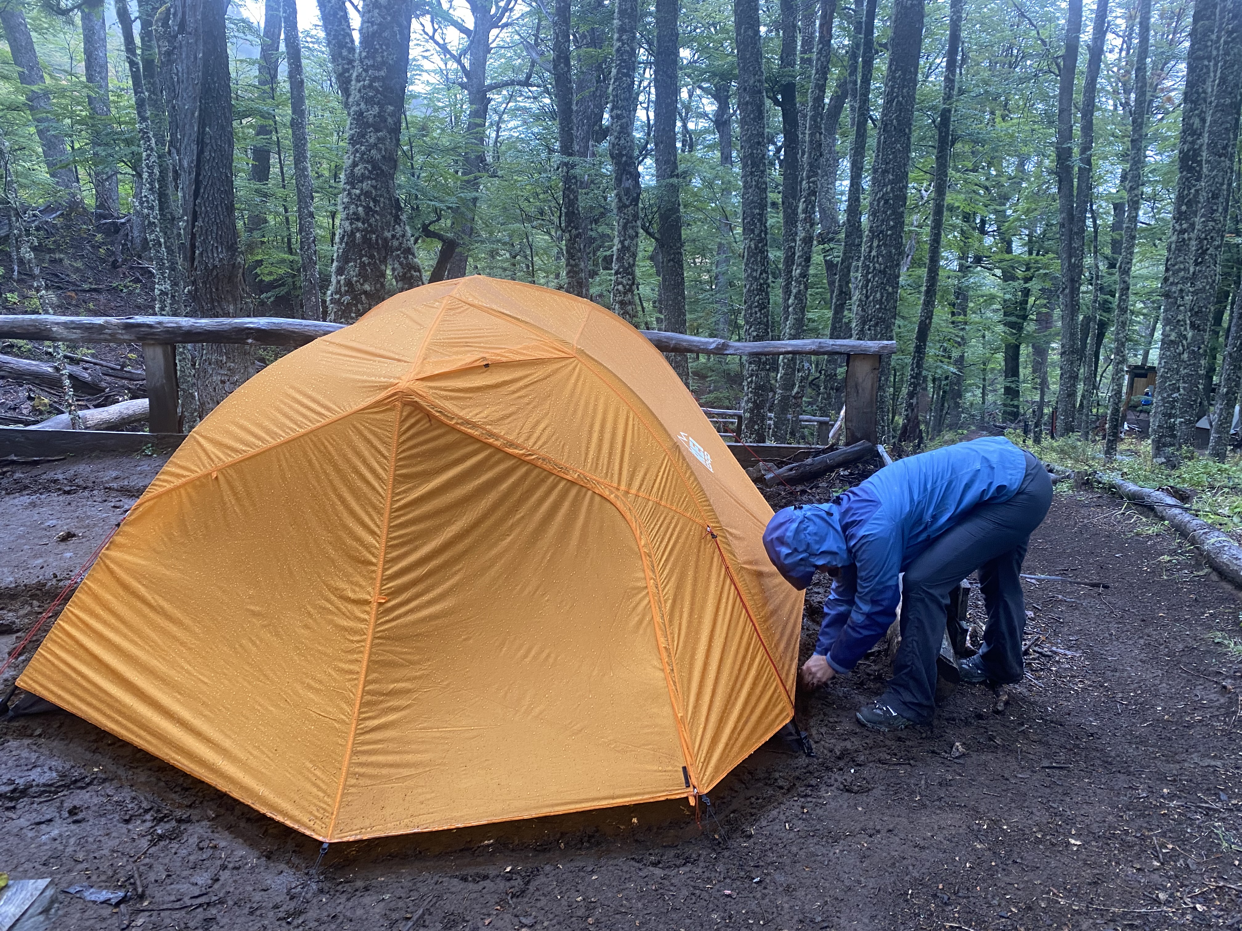
We were at our campsite Porteadores by 2:30 p.m. There is the option to hike further to the second campsite, Neozelandes. Our weather was calling for rain so we opted to stay at the first one to have a shorter hike the next day in case we were in rain for two days. We set up the tents in a flat-ish site. We marveled at our neighbour’s tent and his very deep and intricate trenches. Then after a cup of tea we headed off at an almost jog to Neozelandes to see the laguna and the view from that end.

By the time we reached the second campsite the rain was really falling. Three opted to keep going. The Canadians were worried now about tents and lack of trenches not having been dug. So we two raced back to the tents. To find a nice little river forming between them. We moved a tent, found wooden stakes and madly started digging trenches. Soaked to the skin by the end of it. By the time we were all reunited it was 8 p.m. We slept with all our gear — thankfully our dry sacks really did work! — and we were mostly dry by morning. All in all it was almost 19 km and 226 floors day. (A bit more for three who went all the way to the last laguna.)
Day 4: The last day dawned with blue sky! We were very happy as the forecast had been really grim. We left the site by 10 a.m. And had a leisurely enjoyable hike down. Mostly through some nice open woods, then along a ridge with views down to the Carretera Austral and then ending at a ranch and the last guard’s hut. We were treated to another rainbow on our way out and hordes of grasshoppers. Only 4.8 km and barely 8 floors, we were at the guard’s by noon. We had Aysen Travel Lab pick us up (there is mobile service as you make your way out) and take us to B&B Cabanas Cerro Castillo.
Which is where I found out that my whole family in Mexico had covid, and I had to extend my stay in Chile by half a week. After that news and a lovely hot shower we easily walked into town which is so nice and close and had lunch outdoors at one of the restaurants that were open.
All in all we did about 55 km, four days hiking and three nights on the trail. Our bags weighed in between 11 and 13 kg each.

Food List
We all did a variety of options. We all had oatmeal with dried fruit for breakfast along with coffee or tea. For lunch there was a mix of dried sausage, bagel cheese sandwiches for the first two days, cheese, protein bars, interesting pre-packaged light vegetables, trail mix, apples and carrots. One brave avocado made it, some wraps and two salads which weren’t planned but were enjoyed. For supper we did dehydrated supper packs.
Packing List
Hiking poles (checked bag)
Bowl, utensil, mug
Stoves
4 gas canisters (we used two as we had a super sonic fast stove)
Headlamp and batteries
Toilet paper and anti bac gel
Gloves, toque (hat), warm buff, light buff, sun hat
Face wipes, sun screen, toothbrush/paste, chapstick
First aid kit
Sleeping bag
Mattress
Pillow
Cash and id in ziploc
Knife
2 tents
2 tarps (preferably not falling apart and shredding tarp along the way, but that is another story!)
Long underwear
One change of clothes (trekking pants, short sleeved, shirt, long sleeved shirt)
2 extra pair of thin and 2 extra pair of warm hiking socks
Sleeping socks
Rain coat, rain trousers
Rain cover for backpack
Water shoes
Day pack
Portable phone charger
Large ziplock for garbage
Gas and matches were provided by our transfer
We checked a suitcase which they also brought to the hotel so we had waiting for us on the other end, clean clothes, pajamas and bottles of well-deserved wine.
Now, where shall we go for our next yearly hike, ladies!?
You can enjoy Cerro Castillo without doing the four day hike. There is the three day option, the one day hike, you can use it as a launching point for the Carretera Austral or combine with the Marble Caves. You could also go north to Parque Nacional Quelat and Puyuhapui.


Hi ,
I just wanted to drop a quick note to say thank you for this incredible guide on the Cerro Castillo 4-day hike. Your detailed descriptions and stunning photos have really brought the experience to life for me. It’s clear that a lot of passion and effort went into this post, and it’s been incredibly helpful as I plan my own adventure. I can’t wait to see these breathtaking landscapes in person!
Thanks again for sharing your journey and insights.
Best regards,
Jaseph
LikeLike
Thank you! I hope you have a great hike!
LikeLike